
12 Bus Route Map
View the 12 route map and see all 12 stops along the route. The map of 12 shows where the bus travels and the location of each stop, making it easy to understand the entire route at a glance.
Explore Montgomery County Ride On routes on the map and see where Montgomery County Ride On bus services operate. Use the 12 map to find bus stops and see how the 12 connects different areas along its trip.
All 12 stops on the map are displayed in route order, helping you follow the 12 bus from the first stop to the last.
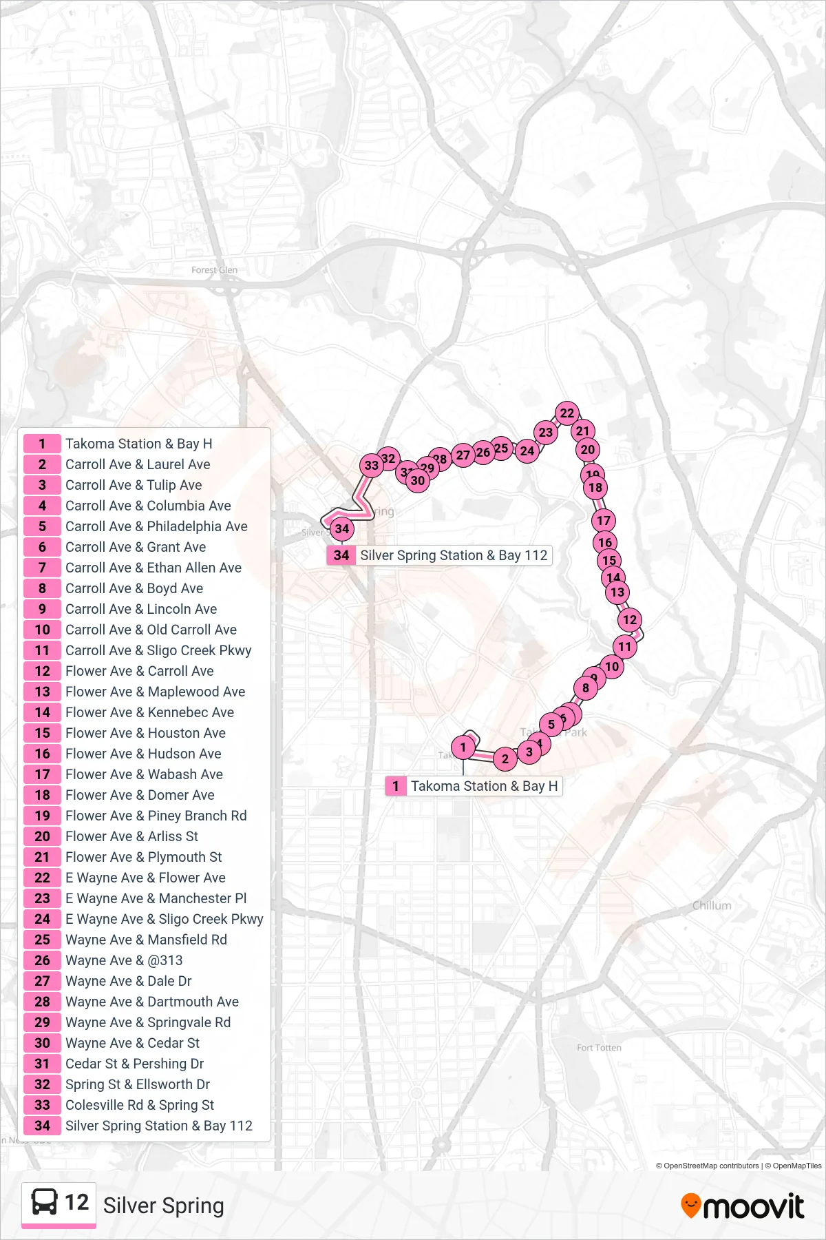
Stops list (12 - Silver Spring)
- Takoma Station & Bay H
- Carroll Ave & Laurel Ave
- Carroll Ave & Tulip Ave
- Carroll Ave & Columbia Ave
- Carroll Ave & Philadelphia Ave
- Carroll Ave & Grant Ave
- Carroll Ave & Ethan Allen Ave
- Carroll Ave & Boyd Ave
- Carroll Ave & Lincoln Ave
- Carroll Ave & Old Carroll Ave
- Carroll Ave & Sligo Creek Pkwy
- Flower Ave & Carroll Ave
- Flower Ave & Maplewood Ave
- Flower Ave & Kennebec Ave
- Flower Ave & Houston Ave
- Flower Ave & Hudson Ave
- Flower Ave & Wabash Ave
- Flower Ave & Domer Ave
- Flower Ave & Piney Branch Rd
- Flower Ave & Arliss St
- Flower Ave & Plymouth St
- E Wayne Ave & Flower Ave
- E Wayne Ave & Manchester Pl
- E Wayne Ave & Sligo Creek Pkwy
- Wayne Ave & Mansfield Rd
- Wayne Ave & @313
- Wayne Ave & Dale Dr
- Wayne Ave & Dartmouth Ave
- Wayne Ave & Springvale Rd
- Wayne Ave & Cedar St
- Cedar St & Pershing Dr
- Spring St & Ellsworth Dr
- Colesville Rd & Spring St
- Silver Spring Station & Bay 112