
120 Bus Route Map
View the 120 route map and see all 120 stops along the route. The map of 120 shows where the bus travels and the location of each stop, making it easy to understand the entire route at a glance.
Explore Offenbacher Verkehrsbetriebe GmbH routes on the map and see where Offenbacher Verkehrsbetriebe GmbH bus services operate. Use the 120 map to find bus stops and see how the 120 connects different areas along its trip.
All 120 stops on the map are displayed in route order, helping you follow the 120 bus from the first stop to the last.
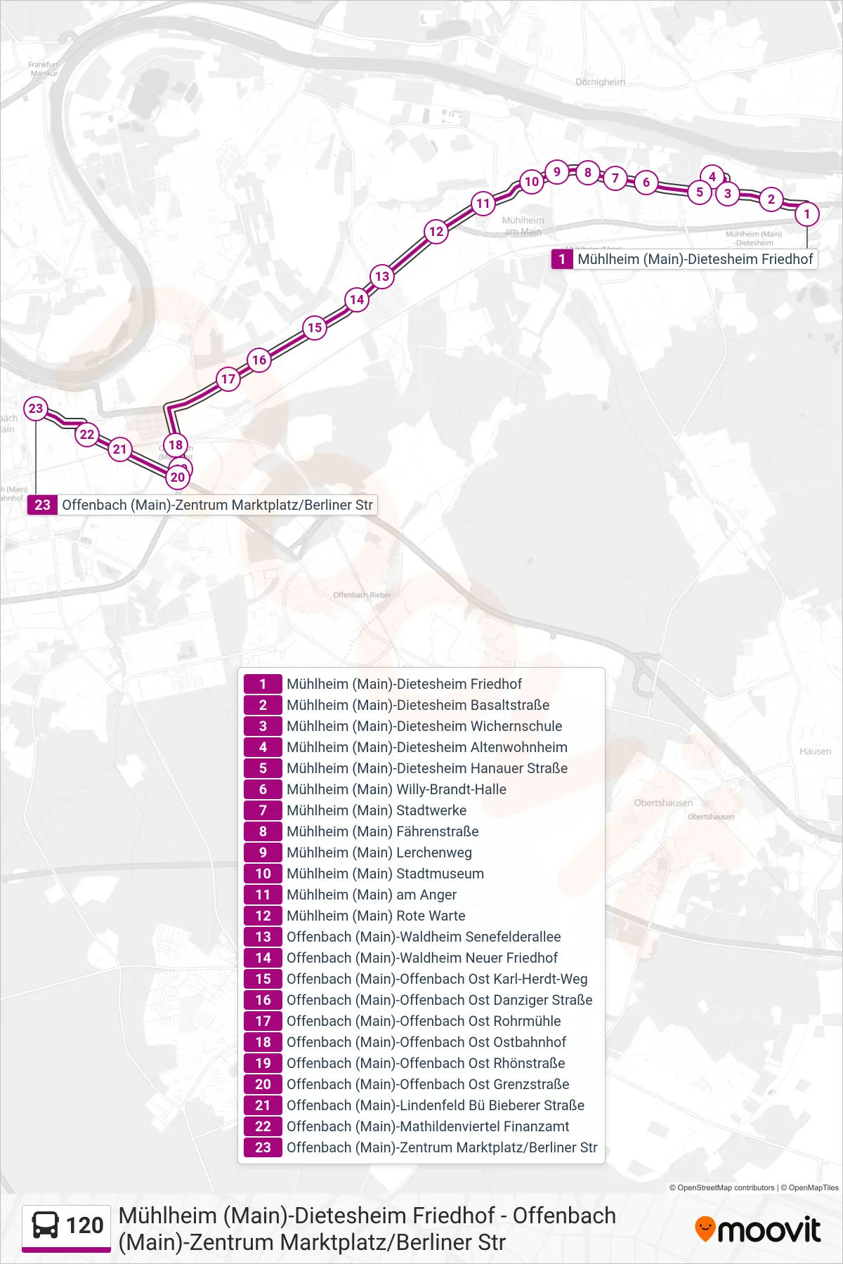
Stops list (120 - Offenbach (Main)-Zentrum Marktplatz/Berliner Str)
- Mühlheim (Main)-Dietesheim Friedhof
- Mühlheim (Main)-Dietesheim Basaltstraße
- Mühlheim (Main)-Dietesheim Wichernschule
- Mühlheim (Main)-Dietesheim Altenwohnheim
- Mühlheim (Main)-Dietesheim Hanauer Straße
- Mühlheim (Main) Willy-Brandt-Halle
- Mühlheim (Main) Stadtwerke
- Mühlheim (Main) Fährenstraße
- Mühlheim (Main) Lerchenweg
- Mühlheim (Main) Stadtmuseum
- Mühlheim (Main) am Anger
- Mühlheim (Main) Rote Warte
- Offenbach (Main)-Waldheim Senefelderallee
- Offenbach (Main)-Waldheim Neuer Friedhof
- Offenbach (Main)-Offenbach Ost Karl-Herdt-Weg
- Offenbach (Main)-Offenbach Ost Danziger Straße
- Offenbach (Main)-Offenbach Ost Rohrmühle
- Offenbach (Main)-Offenbach Ost Ostbahnhof
- Offenbach (Main)-Offenbach Ost Rhönstraße
- Offenbach (Main)-Offenbach Ost Grenzstraße
- Offenbach (Main)-Lindenfeld Bü Bieberer Straße
- Offenbach (Main)-Mathildenviertel Finanzamt
- Offenbach (Main)-Zentrum Marktplatz/Berliner Str