
120L Bus Route Map
View the 120L route map and see all 120L stops along the route. The map of 120L shows where the bus travels and the location of each stop, making it easy to understand the entire route at a glance.
Explore Regional Transportation District routes on the map and see where Regional Transportation District bus services operate. Use the 120L map to find bus stops and see how the 120L connects different areas along its trip.
All 120L stops on the map are displayed in route order, helping you follow the 120L bus from the first stop to the last.
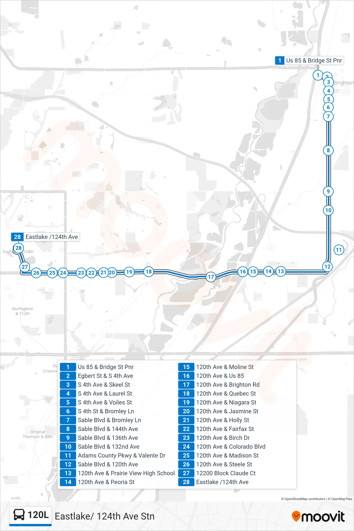
Stops list (120L - Eastlake/ 124th Ave Stn)
- Us 85 & Bridge St Pnr
- Egbert St & S 4th Ave
- S 4th Ave & Skeel St
- S 4th Ave & Laurel St
- S 4th Ave & Voiles St
- S 4th St & Bromley Ln
- Sable Blvd & Bromley Ln
- Sable Blvd & 144th Ave
- Sable Blvd & 136th Ave
- Sable Blvd & 132nd Ave
- Adams County Pkwy & Valente Dr
- Sable Blvd & 120th Ave
- 120th Ave & Prairie View High School
- 120th Ave & Peoria St
- 120th Ave & Moline St
- 120th Ave & Us 85
- 120th Ave & Brighton Rd
- 120th Ave & Quebec St
- 120th Ave & Niagara St
- 120th Ave & Jasmine St
- 120th Ave & Holly St
- 120th Ave & Fairfax St
- 120th Ave & Birch Dr
- 120th Ave & Colorado Blvd
- 120th Ave & Madison St
- 120th Ave & Steele St
- 12200 Block Claude Ct
- Eastlake /124th Ave