
121 Bus Route Map
View the 121 route map and see all 121 stops along the route. The map of 121 shows where the bus travels and the location of each stop, making it easy to understand the entire route at a glance.
Explore KVB Kölner Verkehrs-Betriebe AG routes on the map and see where KVB Kölner Verkehrs-Betriebe AG bus services operate. Use the 121 map to find bus stops and see how the 121 connects different areas along its trip.
All 121 stops on the map are displayed in route order, helping you follow the 121 bus from the first stop to the last.
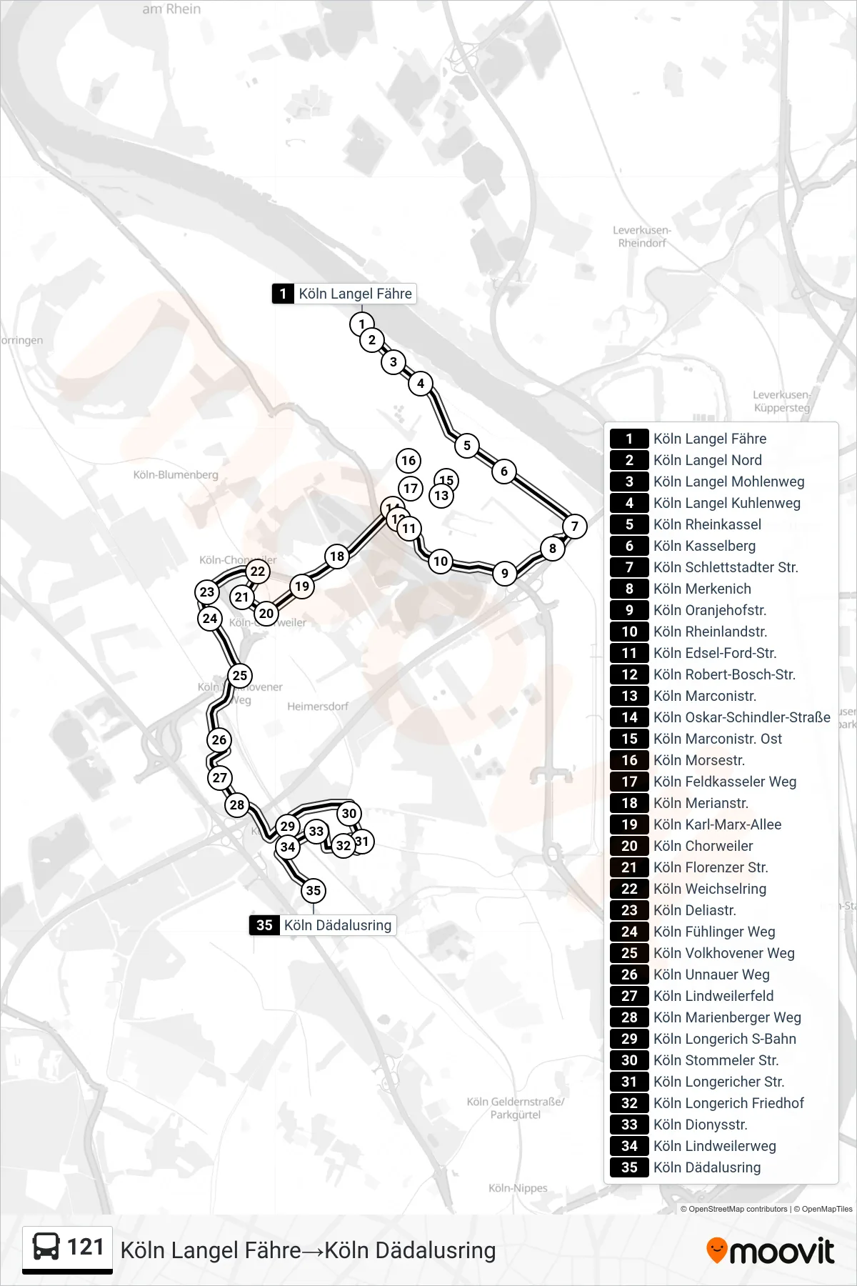
Stops list (121 - Köln Langel Fähre→Köln Dädalusring)
- Köln Langel Fähre
- Köln Langel Nord
- Köln Langel Mohlenweg
- Köln Langel Kuhlenweg
- Köln Rheinkassel
- Köln Kasselberg
- Köln Schlettstadter Str.
- Köln Merkenich
- Köln Oranjehofstr.
- Köln Rheinlandstr.
- Köln Edsel-Ford-Str.
- Köln Robert-Bosch-Str.
- Köln Marconistr.
- Köln Oskar-Schindler-Straße
- Köln Marconistr. Ost
- Köln Morsestr.
- Köln Feldkasseler Weg
- Köln Merianstr.
- Köln Karl-Marx-Allee
- Köln Chorweiler
- Köln Florenzer Str.
- Köln Weichselring
- Köln Deliastr.
- Köln Fühlinger Weg
- Köln Volkhovener Weg
- Köln Unnauer Weg
- Köln Lindweilerfeld
- Köln Marienberger Weg
- Köln Longerich S-Bahn
- Köln Stommeler Str.
- Köln Longericher Str.
- Köln Longerich Friedhof
- Köln Dionysstr.
- Köln Lindweilerweg
- Köln Dädalusring
Change direction
- Route Map - 121 - Köln Dädalusring→Köln Chorweiler
- Route Map - 121 - Köln Langel Fähre→Köln Neusser Str./Gürtel
- Route Map - 121 - Köln Chorweiler→Köln Dädalusring
- Route Map - 121 - Köln Neusser Str./Gürtel→Köln Langel Fähre
- Route Map - 121 - Köln Chorweiler→Köln Langel Fähre
- Route Map - 121 - Köln Dädalusring→Köln Langel Fähre
- Route Map - 121 - Köln Dädalusring→Köln Marconistr.
- Route Map - 121 - Köln Chorweiler→Köln Neusser Str./Gürtel