
122 Bus Route Map
View the 122 route map and see all 122 stops along the route. The map of 122 shows where the bus travels and the location of each stop, making it easy to understand the entire route at a glance.
Explore GB-Tours routes on the map and see where GB-Tours bus services operate. Use the 122 map to find bus stops and see how the 122 connects different areas along its trip.
All 122 stops on the map are displayed in route order, helping you follow the 122 bus from the first stop to the last.
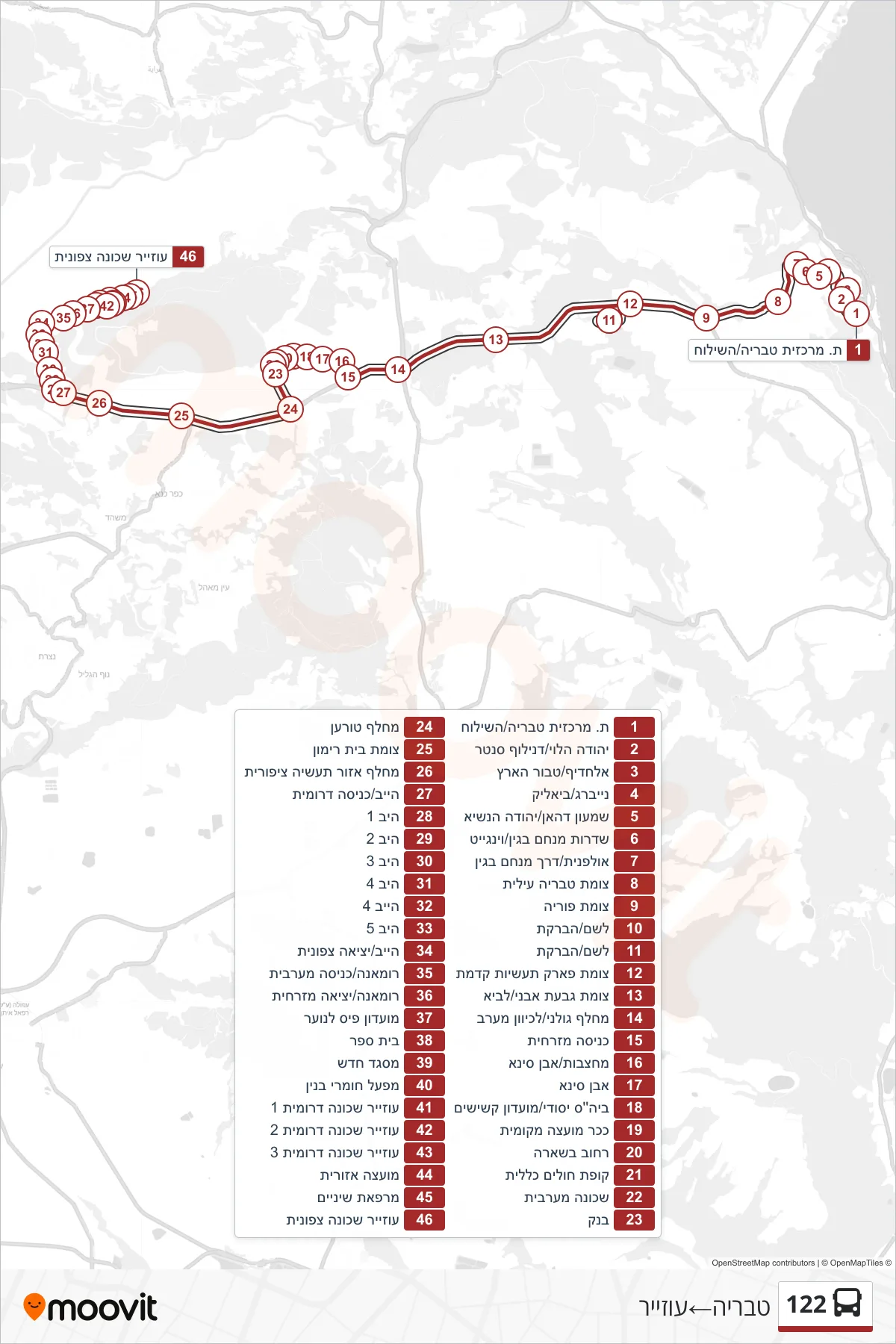

Stops list (122 - Tiberias→Uzeir)
- Tiberias Central Station/HaShiloah
- Yehuda Halevi/Duniloff Center
- Alhadif/Center of the Land
- Neiberg/Bialik
- Shimon Dahan/Yehuda HaNasi
- Menachem Begin Boulevard/Wingate
- Ulpanit/Menachem Begin Road
- Upper Tiberias Junction
- Poriya Junction
- Leshem/HaBareket
- Leshem/HaBareket
- Kidmat Industrial Park Junction
- Givat Avni/Lavi Junction
- Golani Junction/Westbound
- Eastern Entrance
- Quarries/Ibn Sina
- Ibn Sina
- Elementary School/Senior Center
- Local Council Square
- Bishara Street
- Health Clinic
- Western Neighborhood
- Bank
- Toran Junction
- Beit Rimon Junction
- Ziporit Industrial Zone Interchange
- Hayeb/South Entrance
- Hib 1
- Hib 2
- Hib 3
- Hib 4
- Hayev 4
- Hib 5
- Hayeb/North Exit
- Romana/Western Entrance
- Romana/East Exit
- Youth Community Center
- School
- New Mosque
- Building Materials Factory
- Uzayr South District 1
- Uzayr South District 2
- Uzayr South District 3
- Regional Council
- Dental Clinic
- Uzair Northern Neighborhood