
128 Bus Route Map
View the 128 route map and see all 128 stops along the route. The map of 128 shows where the bus travels and the location of each stop, making it easy to understand the entire route at a glance.
Explore KVG Zickenheiner GmbH routes on the map and see where KVG Zickenheiner GmbH bus services operate. Use the 128 map to find bus stops and see how the 128 connects different areas along its trip.
All 128 stops on the map are displayed in route order, helping you follow the 128 bus from the first stop to the last.
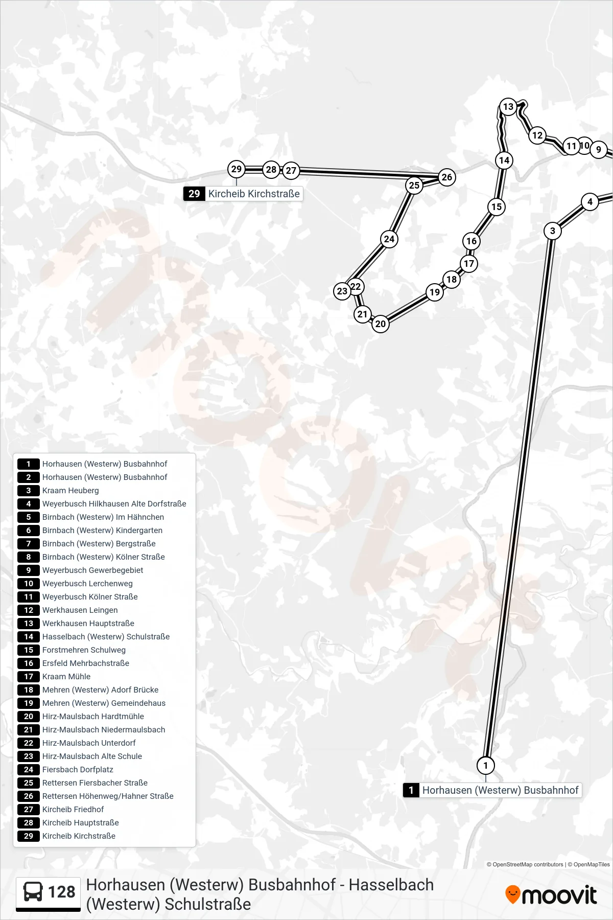
Stops list (128 - Kircheib Kirchstraße)
- Horhausen (Westerw) Busbahnhof
- Horhausen (Westerw) Busbahnhof
- Kraam Heuberg
- Weyerbusch Hilkhausen Alte Dorfstraße
- Birnbach (Westerw) Im Hähnchen
- Birnbach (Westerw) Kindergarten
- Birnbach (Westerw) Bergstraße
- Birnbach (Westerw) Kölner Straße
- Weyerbusch Gewerbegebiet
- Weyerbusch Lerchenweg
- Weyerbusch Kölner Straße
- Werkhausen Leingen
- Werkhausen Hauptstraße
- Hasselbach (Westerw) Schulstraße
- Forstmehren Schulweg
- Ersfeld Mehrbachstraße
- Kraam Mühle
- Mehren (Westerw) Adorf Brücke
- Mehren (Westerw) Gemeindehaus
- Hirz-Maulsbach Hardtmühle
- Hirz-Maulsbach Niedermaulsbach
- Hirz-Maulsbach Unterdorf
- Hirz-Maulsbach Alte Schule
- Fiersbach Dorfplatz
- Rettersen Fiersbacher Straße
- Rettersen Höhenweg/Hahner Straße
- Kircheib Friedhof
- Kircheib Hauptstraße
- Kircheib Kirchstraße