
13 Bus Route Map
View the 13 route map and see all 13 stops along the route. The map of 13 shows where the bus travels and the location of each stop, making it easy to understand the entire route at a glance.
Explore Prato and Province - Tuscan Bus Lines routes on the map and see where Prato and Province - Tuscan Bus Lines bus services operate. Use the 13 map to find bus stops and see how the 13 connects different areas along its trip.
All 13 stops on the map are displayed in route order, helping you follow the 13 bus from the first stop to the last.
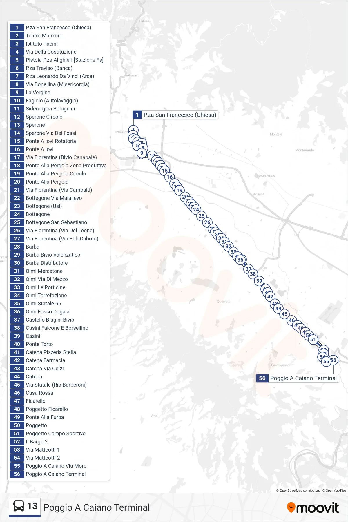
Stops list (13 - Poggio a Caiano Terminal)
- San Francesco Square (Church)
- Manzoni Theater
- Pacini Institute
- Della Costituzione Street
- Pistoia Alighieri Square [Railway Station]
- Treviso Square (Bank)
- Leonardo Da Vinci Square (Arca)
- Bonellina Street (Misericordia)
- The Virgin
- Fagiolo (Car Wash)
- Bolognini Steel Works
- Sperone Circle
- Sperone
- Sperone - Fossi Street
- Ponte A Iovi Roundabout
- Ponte A Iovi
- Via Fiorentina (Bivio Canapale)
- Ponte Alla Pergola Industrial Zone
- Ponte Alla Pergola Circle
- Ponte Alla Pergola
- Via Fiorentina (Via Campalti)
- Bottegone Malallevo Street
- Bottegone (Health Center)
- Bottegone
- Bottegone San Sebastiano
- Via Fiorentina (Via Del Leone)
- Via Fiorentina (Via F.Lli Caboto)
- Barba
- Barba Valenzatico Junction
- Barba Gas Station
- Olmi Mercatone
- Olmi Middle Road
- Olmi Le Porticine
- Olmi Coffee Roasters
- Olmi Statale 66
- Olmi Fosso Dogaia
- Castello Biagini Junction
- Casini Falcone E Borsellino
- Casini
- Ponte Torto
- Catena Stella Pizzeria
- Catena Pharmacy
- Catena Via Colzi
- Chain
- State Road (Rio Barberoni)
- Red House
- Ficarello
- Poggetto Ficarello
- Ponte Alla Furba
- Poggetto
- Poggetto Sports Field
- Il Bargo 2
- Matteotti Street 1
- Matteotti Street 2
- Poggio a Caiano Moro Street
- Poggio a Caiano Terminal