
13 Bus Route Map
View the 13 route map and see all 13 stops along the route. The map of 13 shows where the bus travels and the location of each stop, making it easy to understand the entire route at a glance.
Explore Metropoline routes on the map and see where Metropoline bus services operate. Use the 13 map to find bus stops and see how the 13 connects different areas along its trip.
All 13 stops on the map are displayed in route order, helping you follow the 13 bus from the first stop to the last.
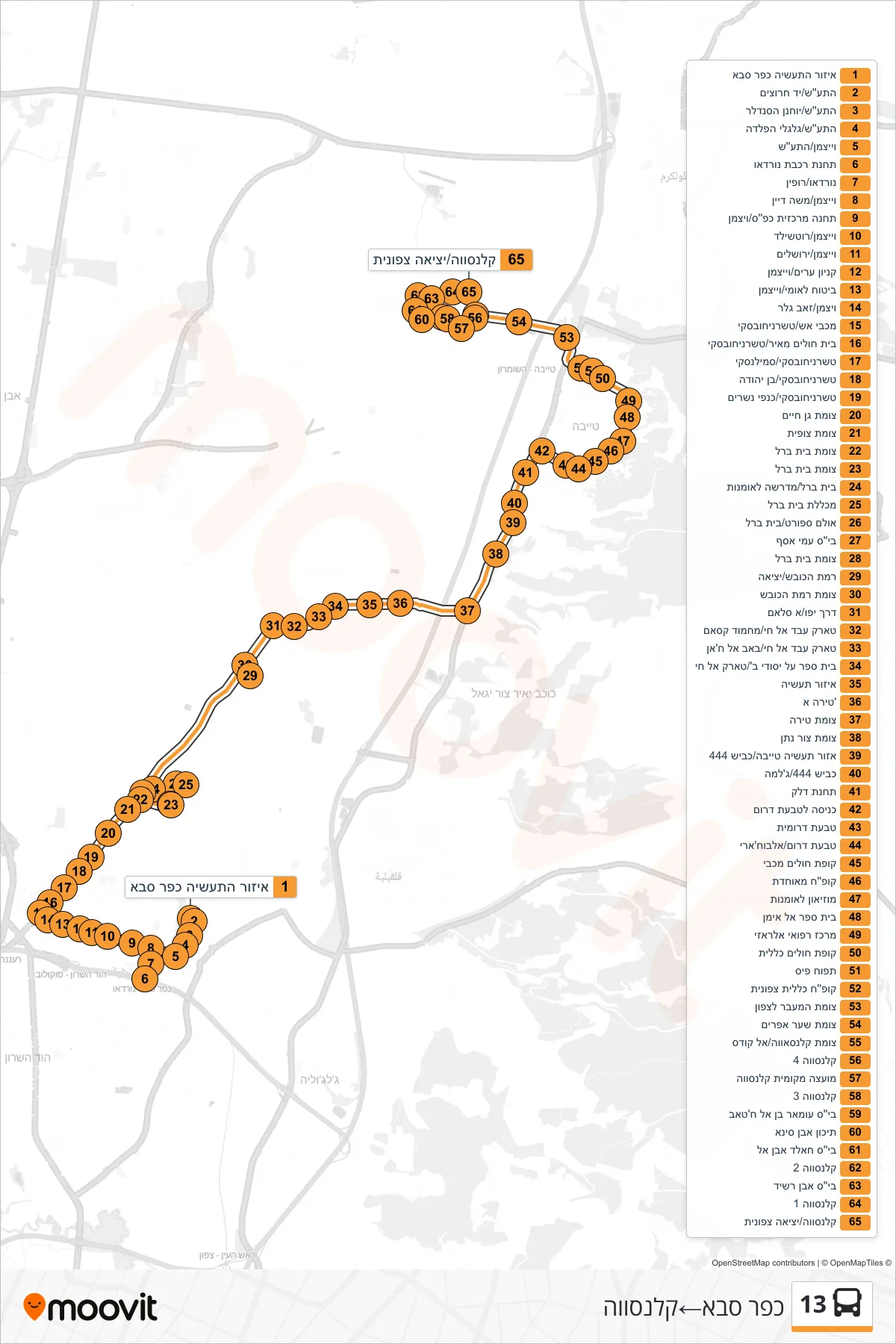
Stops list (13 - Kfar Saba→Qalansawe)
- Kfar Saba Industrial Zone
- HaTa'as/Yad Harutzim
- HaTaas/Yochanan HaSandlar
- Taas/Galgalei HaPelada
- Weizmann/HaTaas
- Nordau Railway Station
- Nordau/Ruppin
- Weizmann/Moshe Dayan
- Kfar Saba Central Station/Weizmann
- Weizmann/Rothschild
- Weizmann/Jerusalem
- Arim Mall/Weizmann
- National Insurance/Weizmann
- Weizmann/Zeev Geller
- Fire Station/Tchernichovsky
- Meir Hospital/Tchernichovsky
- Tchernichovsky/Smilansky
- Tchernichovsky/Ben Yehuda
- Tchernichovsky/Kanfei Nesharim
- Gan Haim Junction
- Tzofit Junction
- Beit Berl Junction
- Beit Berl Junction
- Beit Berl/Art Academy
- Beit Berl College
- Sports Hall/Beit Berl
- Ami Asaf School
- Beit Berl Junction
- Ramat HaKovesh/Exit
- Ramat HaKovesh Junction
- Jaffa Road/Al-Salam
- Tariq Abd al-Hay/Mahmoud Qasam
- Tariq Abd Al-Hai/Bab Al-Khan
- High School B/Tarik Al Hai
- Industrial Zone
- Tira A
- Tira Junction
- Tzur Natan Junction
- Tayibe Industrial Zone/Road 444
- Road 444/Jalama
- Gas Station
- South Ring Entrance
- Southern Ring
- South Ring/Al-Bukhari
- Maccabi Health Center
- Meuhedet Health Center
- Art Museum
- Al Iman School
- Al-Razi Medical Center
- Health Clinic
- Apple Pais
- Clalit Health North
- Northern Crossing Junction
- Sha'ar Efraim Junction
- Kalansawa Junction/Al Quds
- Qalansawe 4
- Qalansuwa Local Council
- Qalansawe 3
- Omar ibn al-Khattab School
- Ibn Sina High School
- Khaled Ibn Al School
- Qalansawe 2
- Ibn Rushd School
- Qalansawe 1
- Kalansawa/North Exit