
13 Bus Route Map
View the 13 route map and see all 13 stops along the route. The map of 13 shows where the bus travels and the location of each stop, making it easy to understand the entire route at a glance.
Explore Regionalbuslinien routes on the map and see where Regionalbuslinien bus services operate. Use the 13 map to find bus stops and see how the 13 connects different areas along its trip.
All 13 stops on the map are displayed in route order, helping you follow the 13 bus from the first stop to the last.
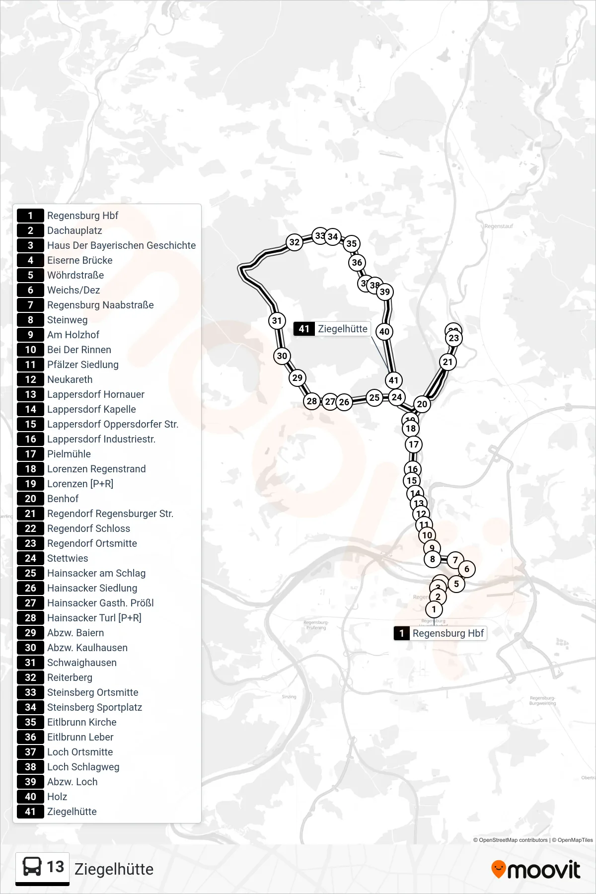
Stops list (13 - Ziegelhütte)
- Regensburg Hbf
- Dachauplatz
- Haus Der Bayerischen Geschichte
- Eiserne Brücke
- Wöhrdstraße
- Weichs/Dez
- Regensburg Naabstraße
- Steinweg
- Am Holzhof
- Bei Der Rinnen
- Pfälzer Siedlung
- Neukareth
- Lappersdorf Hornauer
- Lappersdorf Kapelle
- Lappersdorf Oppersdorfer Str.
- Lappersdorf Industriestr.
- Pielmühle
- Lorenzen Regenstrand
- Lorenzen [P+R]
- Benhof
- Regendorf Regensburger Str.
- Regendorf Schloss
- Regendorf Ortsmitte
- Stettwies
- Hainsacker am Schlag
- Hainsacker Siedlung
- Hainsacker Gasth. Prößl
- Hainsacker Turl [P+R]
- Abzw. Baiern
- Abzw. Kaulhausen
- Schwaighausen
- Reiterberg
- Steinsberg Ortsmitte
- Steinsberg Sportplatz
- Eitlbrunn Kirche
- Eitlbrunn Leber
- Loch Ortsmitte
- Loch Schlagweg
- Abzw. Loch
- Holz
- Ziegelhütte
Change direction
- Route Map - 13 - Oppersdorf Via Schwaighausen
- Route Map - 13 - Arnulfsplatz
- Route Map - 13 - Wolfsegg Ortsmitte
- Route Map - 13 - Schwaighausen Wendeplatz
- Route Map - 13 - Hainsacker Turl [P+R]
- Route Map - 13 - Regensburg Hbf
- Route Map - 13 - Lappersdorf Mittelschule
- Route Map - 13 - Hainsacker
- Route Map - 13 - Taxisstraße