
13 Bus Route Map
View the 13 route map and see all 13 stops along the route. The map of 13 shows where the bus travels and the location of each stop, making it easy to understand the entire route at a glance.
Explore RTC RIDE routes on the map and see where RTC RIDE bus services operate. Use the 13 map to find bus stops and see how the 13 connects different areas along its trip.
All 13 stops on the map are displayed in route order, helping you follow the 13 bus from the first stop to the last.
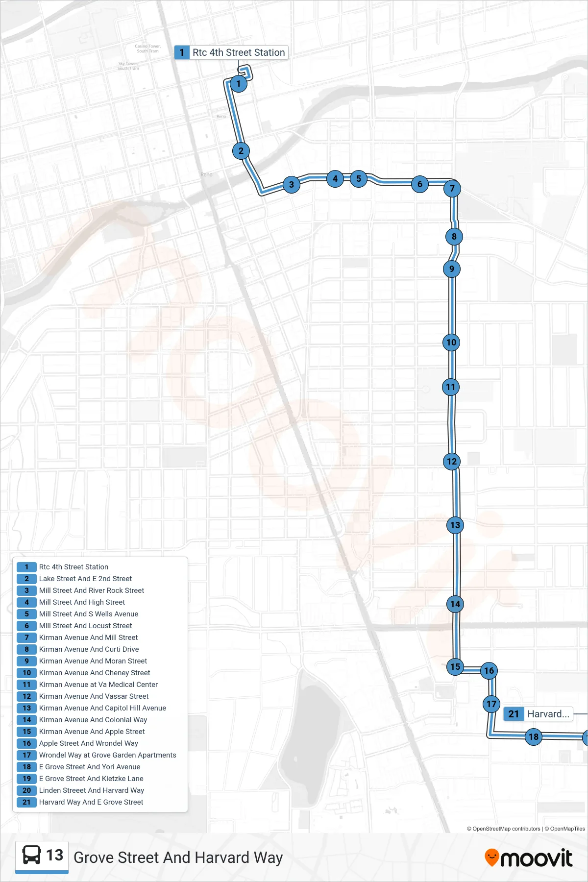
Stops list (13 - Grove Street And Harvard Way)
- Rtc 4th Street Station
- Lake Street And E 2nd Street
- Mill Street And River Rock Street
- Mill Street And High Street
- Mill Street And S Wells Avenue
- Mill Street And Locust Street
- Kirman Avenue And Mill Street
- Kirman Avenue And Curti Drive
- Kirman Avenue And Moran Street
- Kirman Avenue And Cheney Street
- Kirman Avenue at Va Medical Center
- Kirman Avenue And Vassar Street
- Kirman Avenue And Capitol Hill Avenue
- Kirman Avenue And Colonial Way
- Kirman Avenue And Apple Street
- Apple Street And Wrondel Way
- Wrondel Way at Grove Garden Apartments
- E Grove Street And Yori Avenue
- E Grove Street And Kietzke Lane
- Linden Streeet And Harvard Way
- Harvard Way And E Grove Street