
13 Bus Route Map
View the 13 route map and see all 13 stops along the route. The map of 13 shows where the bus travels and the location of each stop, making it easy to understand the entire route at a glance.
Explore Trotta Mobility Fiumicino routes on the map and see where Trotta Mobility Fiumicino bus services operate. Use the 13 map to find bus stops and see how the 13 connects different areas along its trip.
All 13 stops on the map are displayed in route order, helping you follow the 13 bus from the first stop to the last.
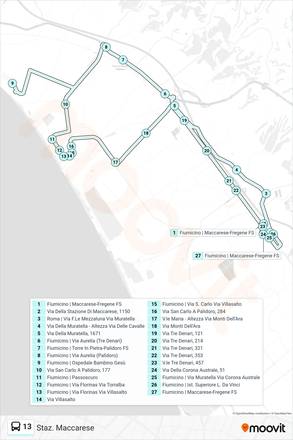
Stops list (13 - Maccarese Station)
- Fiumicino | Maccarese-Fregene Station
- Maccarese Station Street, 1150
- Rome | Mezzaluna Road Muratella Road
- Muratella Street - At Cavalle Street
- Muratella Street, 1671
- Fiumicino via Aurelia (Tre Denari)
- Fiumicino | Torre In Pietra-Palidoro Station
- Fiumicino via Aurelia (Palidoro)
- Fiumicino | Bambino Gesù Hospital
- San Carlo A Palidoro Street, 177
- Fiumicino | Passoscuro
- Fiumicino | Florinas Street Torralba Street
- Fiumicino | Via Florinas Via Villasalto
- Villasalto Street
- Fiumicino | Via San Carlo Via Villasalto
- San Carlo in Palidoro Street, 284
- Maria Avenue - Near Monti Dell'Ara Street
- Monti Dell'Ara Street
- Via Tre Denari, 121
- Three Denari Street, 214
- 321 Tre Denari Street
- Via Tre Denari, 353
- 457 Tre Denari Avenue
- Southern Crown Street, 51
- Fiumicino | Muratella Street Corona Australe Street
- Fiumicino | Leonardo Da Vinci Higher Institute
- Fiumicino | Maccarese-Fregene Station