
13 Bus Route Map
View the 13 route map and see all 13 stops along the route. The map of 13 shows where the bus travels and the location of each stop, making it easy to understand the entire route at a glance.
Explore Stadtverkehr Tüb. routes on the map and see where Stadtverkehr Tüb. bus services operate. Use the 13 map to find bus stops and see how the 13 connects different areas along its trip.
All 13 stops on the map are displayed in route order, helping you follow the 13 bus from the first stop to the last.
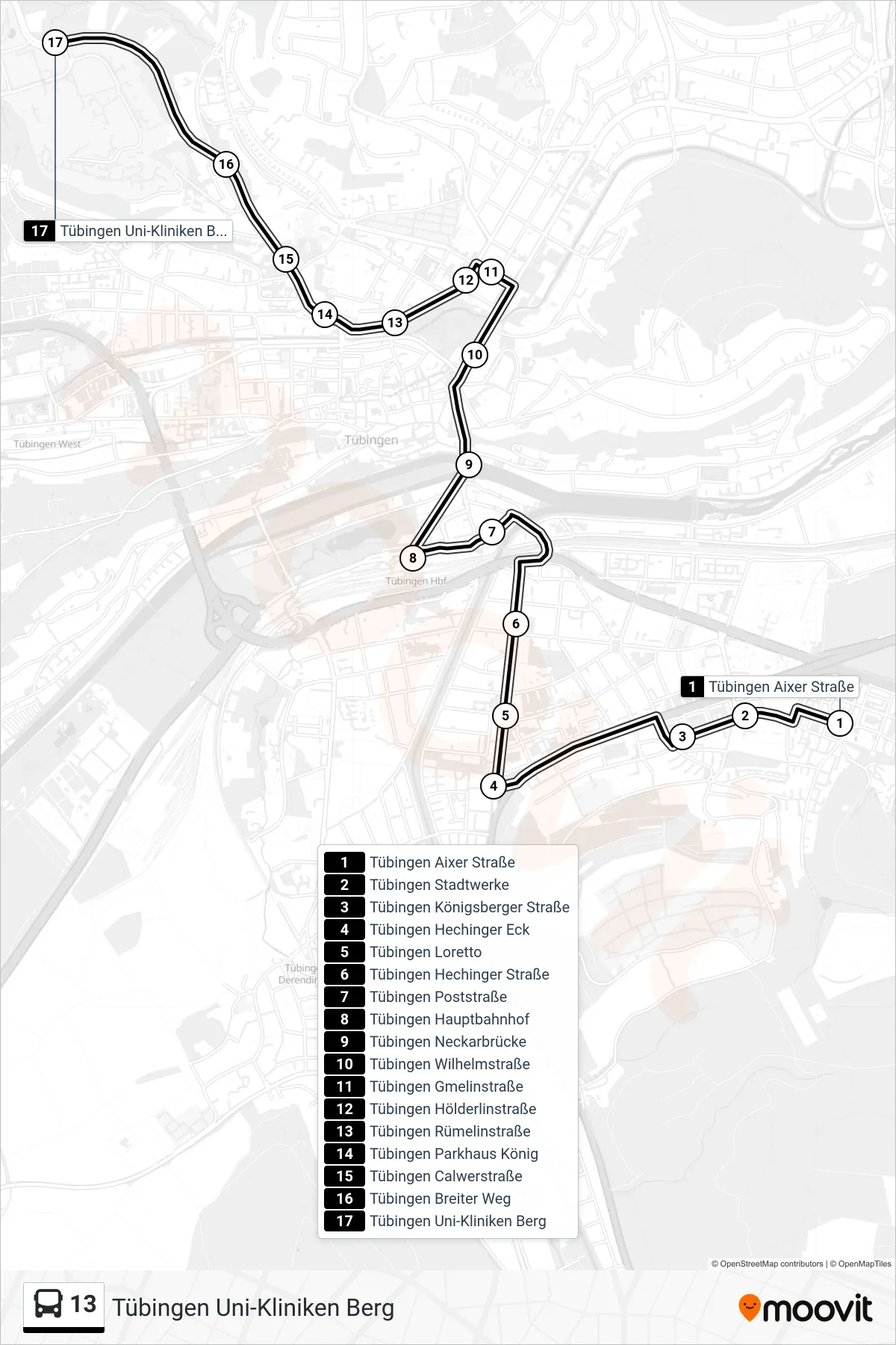
Stops list (13 - Tübingen Uni-Kliniken Berg)
- Tübingen Aixer Straße
- Tübingen Stadtwerke
- Tübingen Königsberger Straße
- Tübingen Hechinger Eck
- Tübingen Loretto
- Tübingen Hechinger Straße
- Tübingen Poststraße
- Tübingen Hauptbahnhof
- Tübingen Neckarbrücke
- Tübingen Wilhelmstraße
- Tübingen Gmelinstraße
- Tübingen Hölderlinstraße
- Tübingen Rümelinstraße
- Tübingen Parkhaus König
- Tübingen Calwerstraße
- Tübingen Breiter Weg
- Tübingen Uni-Kliniken Berg