
130 Bus Route Map
View the 130 route map and see all 130 stops along the route. The map of 130 shows where the bus travels and the location of each stop, making it easy to understand the entire route at a glance.
Explore Regional Transportation District routes on the map and see where Regional Transportation District bus services operate. Use the 130 map to find bus stops and see how the 130 connects different areas along its trip.
All 130 stops on the map are displayed in route order, helping you follow the 130 bus from the first stop to the last.
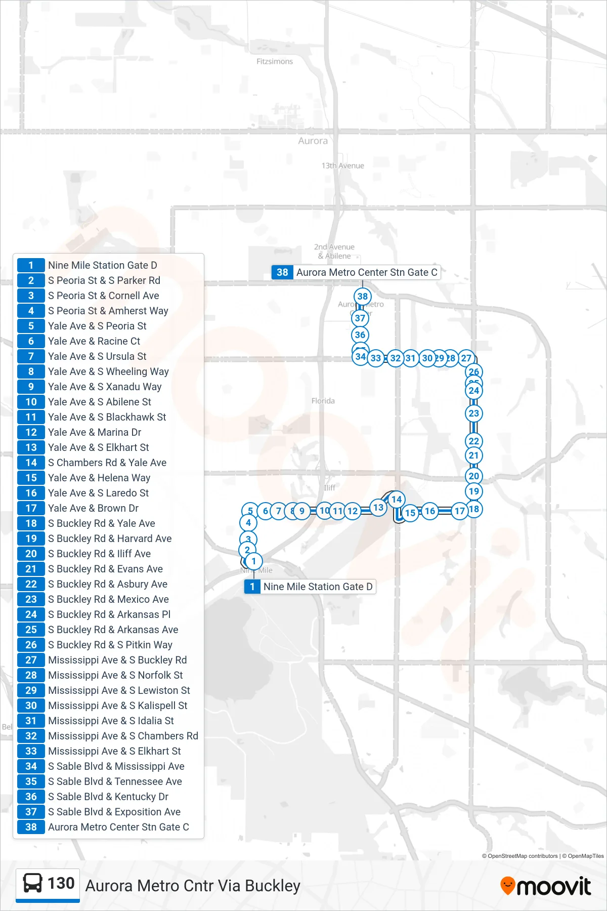
Stops list (130 - Aurora Metro Cntr Via Buckley)
- Nine Mile Station Gate D
- S Peoria St & S Parker Rd
- S Peoria St & Cornell Ave
- S Peoria St & Amherst Way
- Yale Ave & S Peoria St
- Yale Ave & Racine Ct
- Yale Ave & S Ursula St
- Yale Ave & S Wheeling Way
- Yale Ave & S Xanadu Way
- Yale Ave & S Abilene St
- Yale Ave & S Blackhawk St
- Yale Ave & Marina Dr
- Yale Ave & S Elkhart St
- S Chambers Rd & Yale Ave
- Yale Ave & Helena Way
- Yale Ave & S Laredo St
- Yale Ave & Brown Dr
- S Buckley Rd & Yale Ave
- S Buckley Rd & Harvard Ave
- S Buckley Rd & Iliff Ave
- S Buckley Rd & Evans Ave
- S Buckley Rd & Asbury Ave
- S Buckley Rd & Mexico Ave
- S Buckley Rd & Arkansas Pl
- S Buckley Rd & Arkansas Ave
- S Buckley Rd & S Pitkin Way
- Mississippi Ave & S Buckley Rd
- Mississippi Ave & S Norfolk St
- Mississippi Ave & S Lewiston St
- Mississippi Ave & S Kalispell St
- Mississippi Ave & S Idalia St
- Mississippi Ave & S Chambers Rd
- Mississippi Ave & S Elkhart St
- S Sable Blvd & Mississippi Ave
- S Sable Blvd & Tennessee Ave
- S Sable Blvd & Kentucky Dr
- S Sable Blvd & Exposition Ave
- Aurora Metro Center Stn Gate C