
130 Bus Route Map
View the 130 route map and see all 130 stops along the route. The map of 130 shows where the bus travels and the location of each stop, making it easy to understand the entire route at a glance.
Explore Bus Átha Cliath – Dublin Bus routes on the map and see where Bus Átha Cliath – Dublin Bus bus services operate. Use the 130 map to find bus stops and see how the 130 connects different areas along its trip.
All 130 stops on the map are displayed in route order, helping you follow the 130 bus from the first stop to the last.
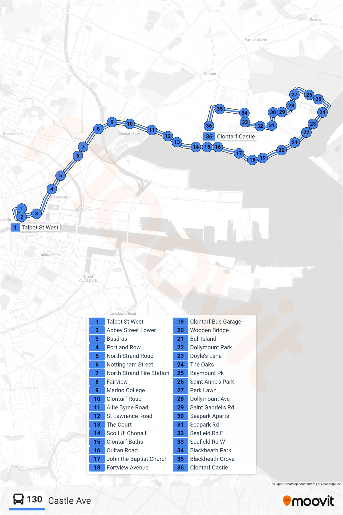
Stops list (130 - Castle Ave)
- Talbot St West
- Abbey Street Lower
- Busáras
- Portland Row
- North Strand Road
- Nottingham Street
- North Strand Fire Station
- Fairview
- Marino College
- Clontarf Road
- Alfie Byrne Road
- St Lawrence Road
- The Court
- Scoil Uí Chonaill
- Clontarf Baths
- Oultan Road
- John the Baptist Church
- Fortview Avenue
- Clontarf Bus Garage
- Wooden Bridge
- Bull Island
- Dollymount Park
- Doyle's Lane
- The Oaks
- Baymount Pk
- Saint Anne's Park
- Park Lawn
- Dollymount Ave
- Saint Gabriel's Rd
- Seapark Aparts
- Seapark Rd
- Seafield Rd E
- Seafield Rd W
- Blackheath Park
- Blackheath Grove
- Clontarf Castle