
130 Bus Route Map
View the 130 route map and see all 130 stops along the route. The map of 130 shows where the bus travels and the location of each stop, making it easy to understand the entire route at a glance.
Explore SEPTA routes on the map and see where SEPTA bus services operate. Use the 130 map to find bus stops and see how the 130 connects different areas along its trip.
All 130 stops on the map are displayed in route order, helping you follow the 130 bus from the first stop to the last.
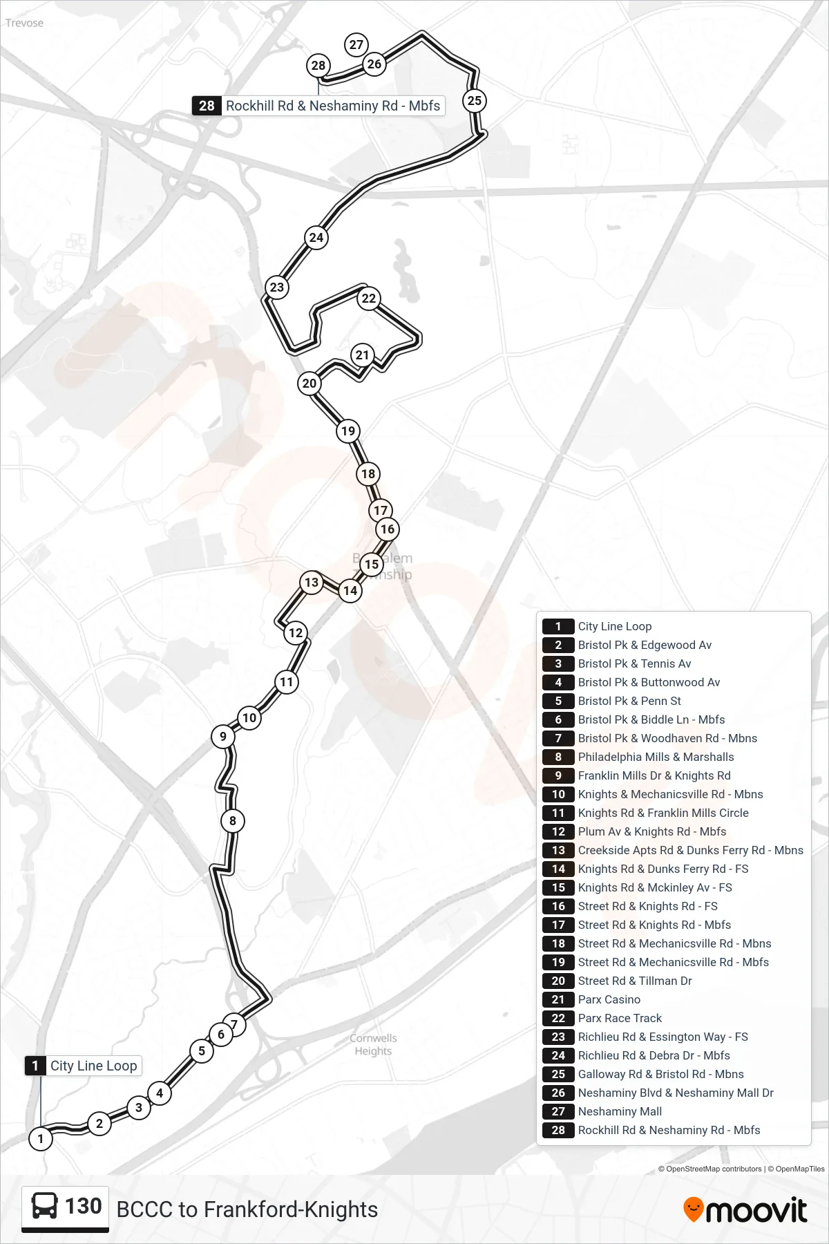
Stops list (130 - Neshaminy Mall)
- City Line Loop
- Bristol Pk & Edgewood Av
- Bristol Pk & Tennis Av
- Bristol Pk & Buttonwood Av
- Bristol Pk & Penn St
- Bristol Pk & Biddle Ln - Mbfs
- Bristol Pk & Woodhaven Rd - Mbns
- Philadelphia Mills & Marshalls
- Franklin Mills Dr & Knights Rd
- Knights & Mechanicsville Rd - Mbns
- Knights Rd & Franklin Mills Circle
- Plum Av & Knights Rd - Mbfs
- Creekside Apts Rd & Dunks Ferry Rd - Mbns
- Knights Rd & Dunks Ferry Rd - FS
- Knights Rd & Mckinley Av - FS
- Street Rd & Knights Rd - FS
- Street Rd & Knights Rd - Mbfs
- Street Rd & Mechanicsville Rd - Mbns
- Street Rd & Mechanicsville Rd - Mbfs
- Street Rd & Tillman Dr
- Parx Casino
- Parx Race Track
- Richlieu Rd & Essington Way - FS
- Richlieu Rd & Debra Dr - Mbfs
- Galloway Rd & Bristol Rd - Mbns
- Neshaminy Blvd & Neshaminy Mall Dr
- Neshaminy Mall
- Rockhill Rd & Neshaminy Rd - Mbfs