
131 Bus Route Map
View the 131 route map and see all 131 stops along the route. The map of 131 shows where the bus travels and the location of each stop, making it easy to understand the entire route at a glance.
Explore SEPTA routes on the map and see where SEPTA bus services operate. Use the 131 map to find bus stops and see how the 131 connects different areas along its trip.
All 131 stops on the map are displayed in route order, helping you follow the 131 bus from the first stop to the last.
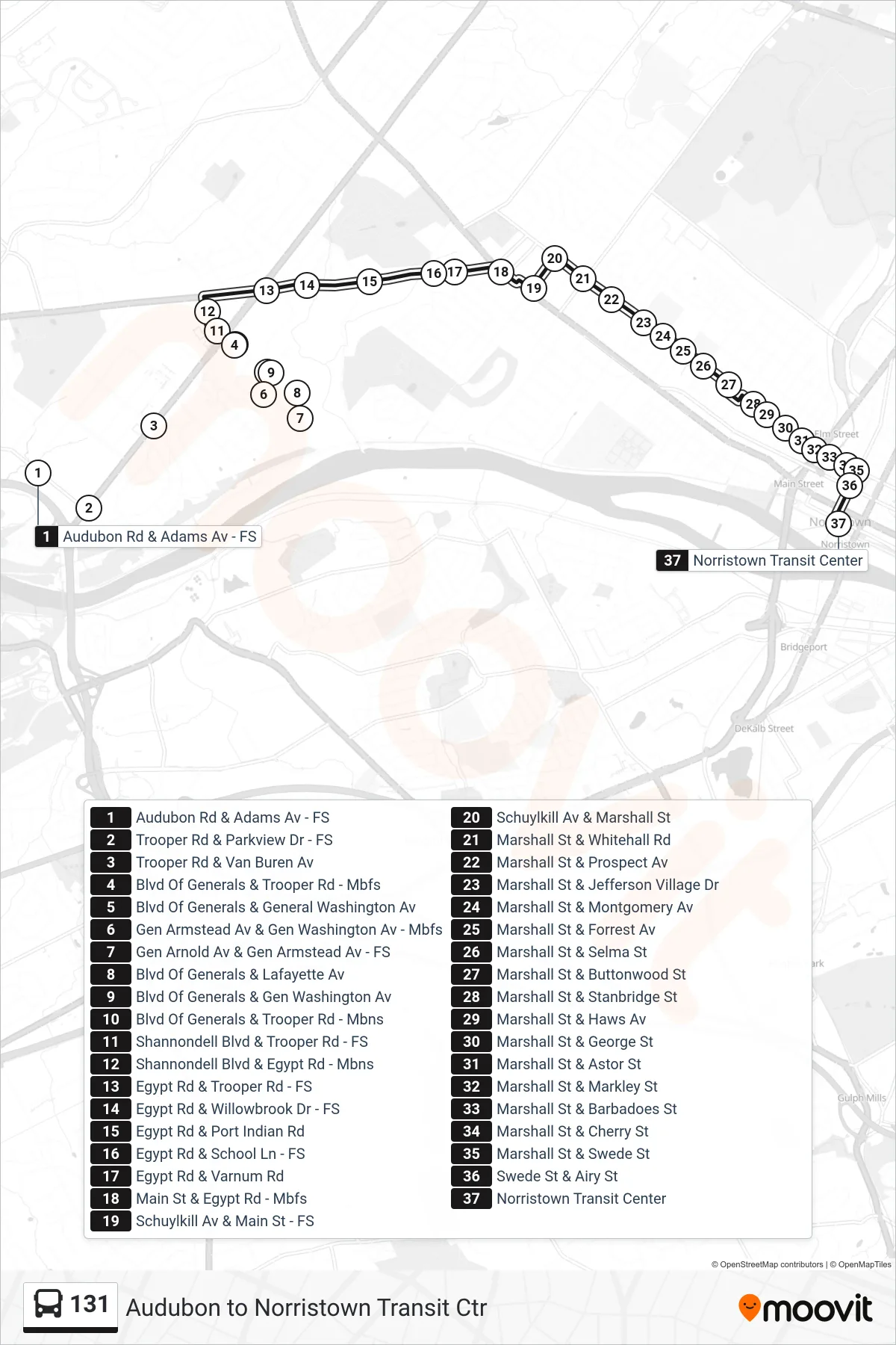
Stops list (131 - Norristown Transit Center)
- Audubon Rd & Adams Av - FS
- Trooper Rd & Parkview Dr - FS
- Trooper Rd & Van Buren Av
- Blvd Of Generals & Trooper Rd - Mbfs
- Blvd Of Generals & General Washington Av
- Gen Armstead Av & Gen Washington Av - Mbfs
- Gen Arnold Av & Gen Armstead Av - FS
- Blvd Of Generals & Lafayette Av
- Blvd Of Generals & Gen Washington Av
- Blvd Of Generals & Trooper Rd - Mbns
- Shannondell Blvd & Trooper Rd - FS
- Shannondell Blvd & Egypt Rd - Mbns
- Egypt Rd & Trooper Rd - FS
- Egypt Rd & Willowbrook Dr - FS
- Egypt Rd & Port Indian Rd
- Egypt Rd & School Ln - FS
- Egypt Rd & Varnum Rd
- Main St & Egypt Rd - Mbfs
- Schuylkill Av & Main St - FS
- Schuylkill Av & Marshall St
- Marshall St & Whitehall Rd
- Marshall St & Prospect Av
- Marshall St & Jefferson Village Dr
- Marshall St & Montgomery Av
- Marshall St & Forrest Av
- Marshall St & Selma St
- Marshall St & Buttonwood St
- Marshall St & Stanbridge St
- Marshall St & Haws Av
- Marshall St & George St
- Marshall St & Astor St
- Marshall St & Markley St
- Marshall St & Barbadoes St
- Marshall St & Cherry St
- Marshall St & Swede St
- Swede St & Airy St
- Norristown Transit Center