
131 Bus Route Map
View the 131 route map and see all 131 stops along the route. The map of 131 shows where the bus travels and the location of each stop, making it easy to understand the entire route at a glance.
Explore Ruhrbahn Mülheim routes on the map and see where Ruhrbahn Mülheim bus services operate. Use the 131 map to find bus stops and see how the 131 connects different areas along its trip.
All 131 stops on the map are displayed in route order, helping you follow the 131 bus from the first stop to the last.
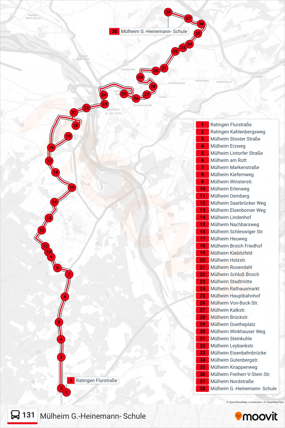
Stops list (131 - Mülheim G.-Heinemann- Schule)
- Ratingen Flurstraße
- Ratingen Kahlenbergsweg
- Mülheim Stooter Straße
- Mülheim Erzweg
- Mülheim Lintorfer Straße
- Mülheim am Rott
- Mülheim Markenstraße
- Mülheim Kiefernweg
- Mülheim Winsterstr.
- Mülheim Erlenweg
- Mülheim Oemberg
- Mülheim Saarbrücker Weg
- Mülheim Elsenborner Weg
- Mülheim Lindenhof
- Mülheim Nachbarsweg
- Mülheim Schleswiger Str.
- Mülheim Heuweg
- Mülheim Broich Friedhof
- Mülheim Kiebitzfeld
- Mülheim Holzstr.
- Mülheim Rosendahl
- Mülheim Schloß Broich
- Mülheim Stadtmitte
- Mülheim Rathausmarkt
- Mülheim Hauptbahnhof
- Mülheim Von-Bock-Str.
- Mülheim Kalkstr.
- Mülheim Brückstr.
- Mülheim Goetheplatz
- Mülheim Winkhauser Weg
- Mülheim Steinkuhle
- Mülheim Leybankstr.
- Mülheim Eisenbahnbrücke
- Mülheim Gutenbergstr.
- Mülheim Knappenweg
- Mülheim Freiherr-V-Stein Str.
- Mülheim Nordstraße
- Mülheim G.-Heinemann- Schule