
133 Bus Route Map
View the 133 route map and see all 133 stops along the route. The map of 133 shows where the bus travels and the location of each stop, making it easy to understand the entire route at a glance.
Explore Kavim routes on the map and see where Kavim bus services operate. Use the 133 map to find bus stops and see how the 133 connects different areas along its trip.
All 133 stops on the map are displayed in route order, helping you follow the 133 bus from the first stop to the last.
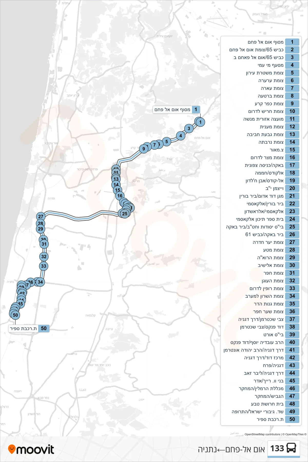
Stops list (133 - Umm al-Fahm→Netanya)
- Um al-Fahm Terminal
- Road 65/Um El Fahm Junction
- Road 65/Umm al-Fahm B
- Mi Ami Junction
- Eiron Police Junction
- Ar'ara Junction
- Ara Junction
- Bartaa Junction
- Kafr Qara Junction
- Harish Junction South
- Menashe Regional Council
- Maanit Junction
- Givat Haviva Junction
- Narbata Junction
- Maor Junction
- Metzer Junction South
- Baqa/North Entrance
- Al-Quds/Greenhouse
- Al-Quds/Ibn Khaldun
- Weizmann 12
- Magen David Adom/Bir Borin
- Bir Burin/Al-Qasmi
- Al-Qasmi/Al-Rashdon
- Al-Qasmi High School
- Yesodot School/Bir Baka
- Bir Baka/Road 61
- Ya'ar Hadera Junction
- Mata Junction
- Haroeh Junction
- Elishiv Junction
- Hefer Junction
- HaOgen Junction
- Ruppin Junction South
- HaSharon Junction West
- Ganot Hadar Junction
- Shaar Hefer Junction
- Tzvi Shachterman/Degania Road
- David Pincas/Tzvi Shechterman
- Ort School
- Rabbi Ovadia Yosef/David Pincus
- Degania Road/Rabbi Yehuda Unterman
- David Center/Degania Road
- Degania/Perach
- Degania Road/Lieber Zeev
- Benny W. Reich/Adar
- Hamlin College/HaMechkar
- HaGavish/HaMehkar
- Teva Factory
- Israel Heroes Boulevard/Hatrufa
- Sapir Railway Station