
133 Bus Route Map
View the 133 route map and see all 133 stops along the route. The map of 133 shows where the bus travels and the location of each stop, making it easy to understand the entire route at a glance.
Explore GTT Suburban Service routes on the map and see where GTT Suburban Service bus services operate. Use the 133 map to find bus stops and see how the 133 connects different areas along its trip.
All 133 stops on the map are displayed in route order, helping you follow the 133 bus from the first stop to the last.
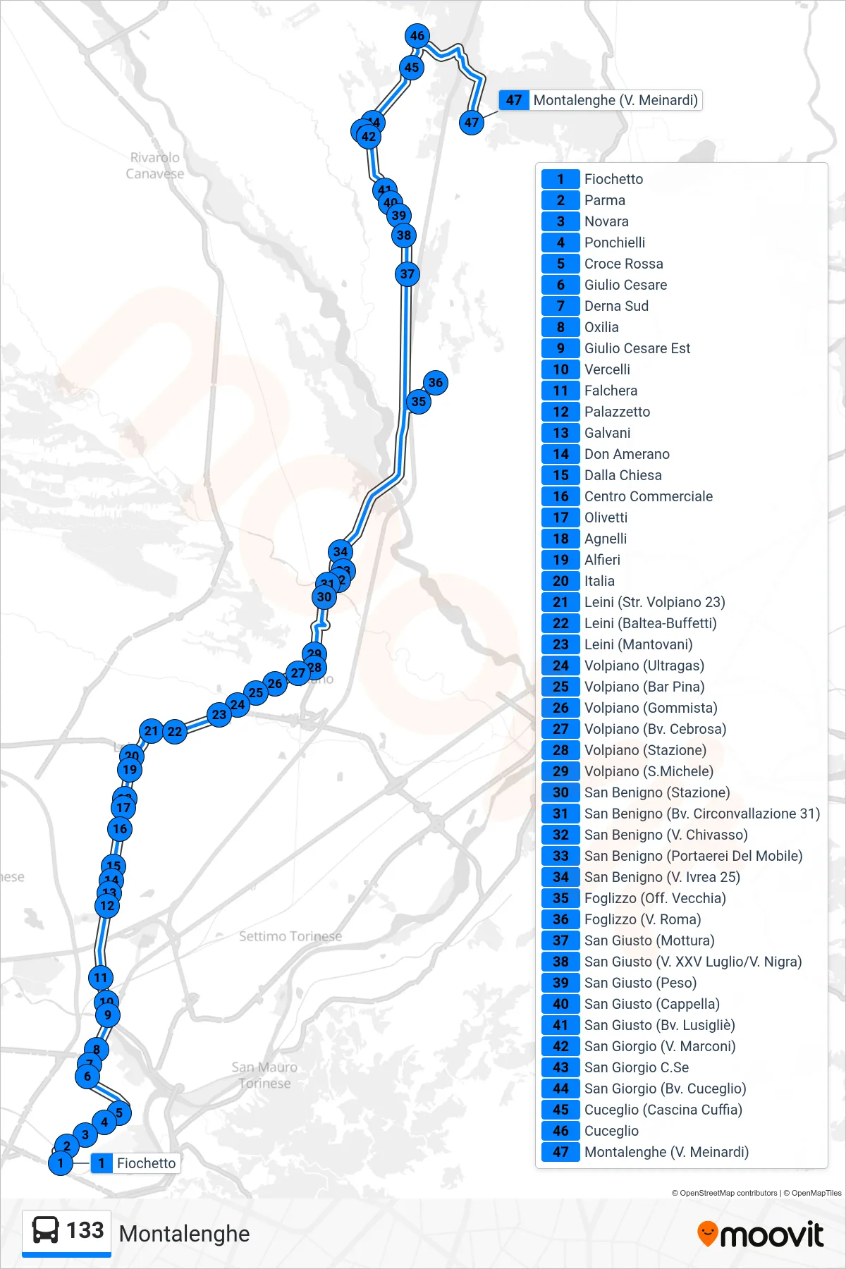
Stops list (133 - Montalenghe)
- Fiochetto
- Parma
- Novara
- Ponchielli
- Red Cross
- Julius Caesar
- Derna South
- Oxilia
- Julius Caesar East
- Vercelli
- Falchera
- Small Palace
- Galvani
- Don Amerano
- Dalla Chiesa
- Shopping Center
- Olivetti
- Agnelli
- Alfieri
- Italy
- Leini (Volpiano Road 23)
- Leini (Baltea-Buffetti)
- Leini (Mantovani)
- Volpiano (Ultragas)
- Volpiano (Bar Pina)
- Volpiano (Tire Shop)
- Volpiano (Cebrosa Junction)
- Volpiano (Station)
- Volpiano (San Michele)
- San Benigno (Station)
- San Benigno (Ring Road Junction 31)
- San Benigno (Chivasso St)
- San Benigno (Furniture Center)
- San Benigno (Ivrea St 25)
- Foglizzo (Old Workshop)
- Foglizzo (Via Roma)
- San Giusto (Mottura)
- San Giusto (Via XXV July/Via Nigra)
- San Giusto (Weight Station)
- San Giusto (Chapel)
- San Giusto (Lusigliè Jct.)
- San Giorgio (Marconi St)
- San Giorgio C.Se
- San Giorgio (Cuceglio Junction)
- Cuceglio (Cuffia Farm)
- Cuceglio
- Montalenghe (Meinardi St)