
135 Bus Route Map
View the 135 route map and see all 135 stops along the route. The map of 135 shows where the bus travels and the location of each stop, making it easy to understand the entire route at a glance.
Explore Regional Transportation District routes on the map and see where Regional Transportation District bus services operate. Use the 135 map to find bus stops and see how the 135 connects different areas along its trip.
All 135 stops on the map are displayed in route order, helping you follow the 135 bus from the first stop to the last.
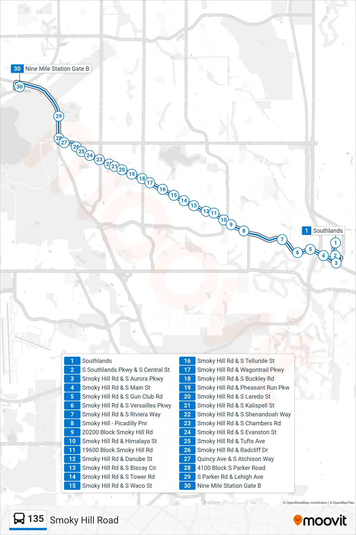
Stops list (135 - Nine Mile Stn Via Smoky Hill)
- Southlands
- S Southlands Pkwy & S Central St
- Smoky Hill Rd & S Aurora Pkwy
- Smoky Hill Rd & S Main St
- Smoky Hill Rd & S Gun Club Rd
- Smoky Hill Rd & S Versailles Pkwy
- Smoky Hill Rd & S Riviera Way
- Smoky Hill - Picadilly Pnr
- 20200 Block Smoky Hill Rd
- Smoky Hill Rd & Himalaya St
- 19600 Block Smoky Hill Rd
- Smoky Hill Rd & Danube St
- Smoky Hill Rd & S Biscay Cir
- Smoky Hill Rd & S Tower Rd
- Smoky Hill Rd & S Waco St
- Smoky Hill Rd & S Telluride St
- Smoky Hill Rd & Wagontrail Pkwy
- Smoky Hill Rd & S Buckley Rd
- Smoky Hill Rd & Pheasant Run Pkw
- Smoky Hill Rd & S Laredo St
- Smoky Hill Rd & S Kalispell St
- Smoky Hill Rd & S Shenandoah Way
- Smoky Hill Rd & S Chambers Rd
- Smoky Hill Rd & S Evanston St
- Smoky Hill Rd & Tufts Ave
- Smoky Hill Rd & Radcliff Dr
- Quincy Ave & S Atchison Way
- 4100 Block S Parker Road
- S Parker Rd & Lehigh Ave
- Nine Mile Station Gate B