
139 Bus Route Map
View the 139 route map and see all 139 stops along the route. The map of 139 shows where the bus travels and the location of each stop, making it easy to understand the entire route at a glance.
Explore Kavim routes on the map and see where Kavim bus services operate. Use the 139 map to find bus stops and see how the 139 connects different areas along its trip.
All 139 stops on the map are displayed in route order, helping you follow the 139 bus from the first stop to the last.
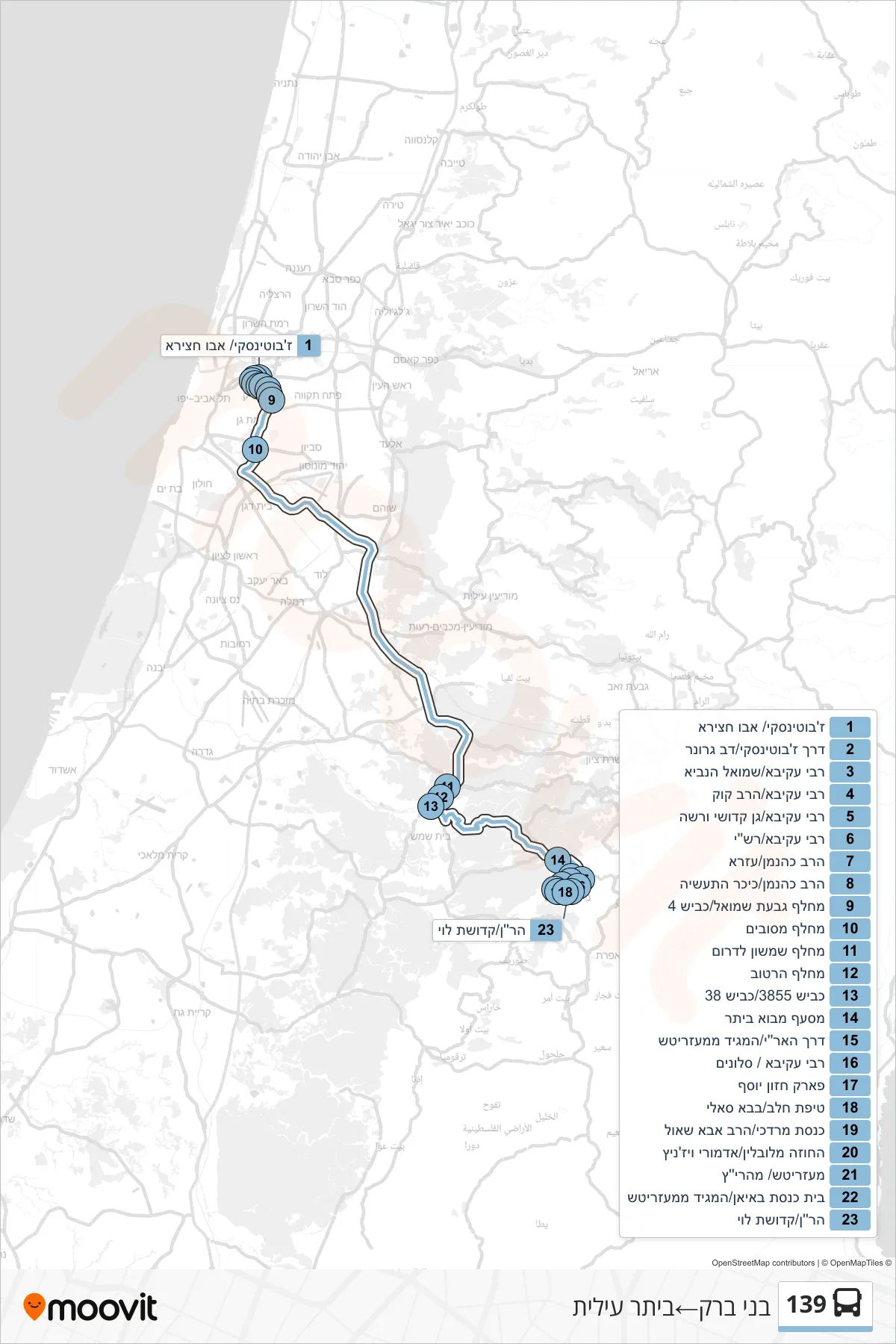
Stops list (139 - Bnei Brak→Beitar Illit)
- Jabotinsky/Abu Hatseira
- Jabotinsky Road/Dov Gruner
- Rabbi Akiva/Shmuel HaNavi
- Rabbi Akiva/HaRav Kook
- Rabbi Akiva/Kedoshei Warsaw Garden
- Rabbi Akiva/Rashi
- Rabbi Kahaneman/Ezra
- Rabbi Kahaneman/Industry Square
- Givat Shmuel Interchange/Road 4
- Mesubim Interchange
- Shimshon Interchange South
- Hartuv Interchange
- Road 3855/Road 38
- Mevo Beitar Junction
- HaAri Road/Maggid of Mezeritch
- Rabbi Akiva/Slonim
- Chazon Yosef Park
- Tipat Halav/Baba Sali
- Knesset Mordechai/HaRav Abba Shaul
- Chozeh MiLublin/Admor Vizhnitz
- Mezritsh/Maharitz
- Bayan Synagogue/Maggid of Mezeritch
- HaRan/Kdushat Levi