
14 Bus Route Map
View the 14 route map and see all 14 stops along the route. The map of 14 shows where the bus travels and the location of each stop, making it easy to understand the entire route at a glance.
Explore Lowell Regional Transit Authority routes on the map and see where Lowell Regional Transit Authority bus services operate. Use the 14 map to find bus stops and see how the 14 connects different areas along its trip.
All 14 stops on the map are displayed in route order, helping you follow the 14 bus from the first stop to the last.
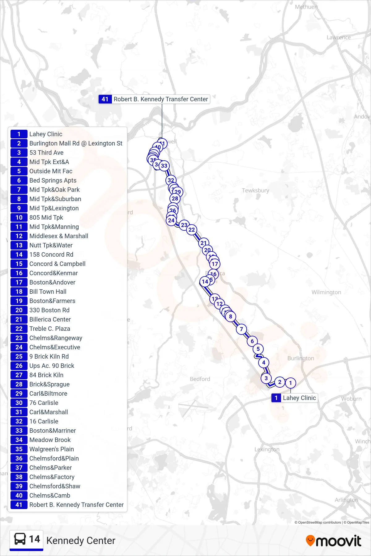
Stops list (14 - Kennedy Center)
- Lahey Clinic
- Burlington Mall Rd @ Lexington St
- 53 Third Ave
- Mid Tpk Ext&A
- Outside Mit Fac
- Bed Springs Apts
- Mid Tpk&Oak Park
- Mid Tpk&Suburban
- Mid Tp&Lexington
- 805 Mid Tpk
- Mid Tpk&Manning
- Middlesex & Marshall
- Nutt Tpk&Water
- 158 Concord Rd
- Concord & Campbell
- Concord&Kenmar
- Boston&Andover
- Bill Town Hall
- Boston&Farmers
- 330 Boston Rd
- Billerica Center
- Treble C. Plaza
- Chelms&Rangeway
- Chelms&Executive
- 9 Brick Kiln Rd
- Ups Ac. 90 Brick
- 84 Brick Kiln
- Brick&Sprague
- Carl&Biltmore
- 76 Carlisle
- Carl&Marshall
- 16 Carlisle
- Boston&Marriner
- Meadow Brook
- Walgreen's Plain
- Chelmsford&Plain
- Chelms&Parker
- Chelms&Factory
- Chelmsford&Shaw
- Chelms&Camb
- Robert B. Kennedy Transfer Center