
14 Bus Route Map
View the 14 route map and see all 14 stops along the route. The map of 14 shows where the bus travels and the location of each stop, making it easy to understand the entire route at a glance.
Explore MBTA routes on the map and see where MBTA bus services operate. Use the 14 map to find bus stops and see how the 14 connects different areas along its trip.
All 14 stops on the map are displayed in route order, helping you follow the 14 bus from the first stop to the last.
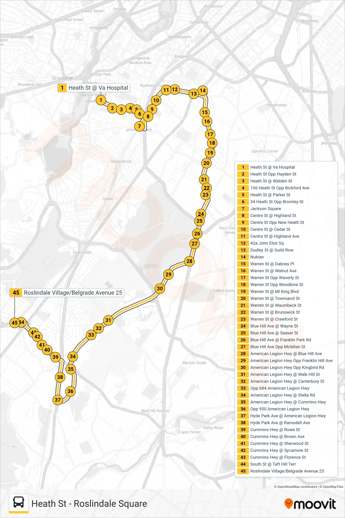
Stops list (14 - Roslindale Square)
- Heath St @ Va Hospital
- Heath St Opp Hayden St
- Heath St @ Walden St
- 106 Heath St Opp Bickford Ave
- Heath St @ Parker St
- 34 Heath St Opp Bromley St
- Jackson Square
- Centre St @ Highland St
- Centre St Opp New Heath St
- Centre St @ Cedar St
- Centre St @ Highland Ave
- 42a John Eliot Sq
- Dudley St @ Guild Row
- Nubian
- Warren St @ Dabney Pl
- Warren St @ Walnut Ave
- Warren St Opp Waverly St
- Warren St Opp Woodbine St
- Warren St @ Ml King Blvd
- Warren St @ Townsend St
- Warren St @ Waumbeck St
- Warren St @ Brunswick St
- Warren St @ Crawford St
- Blue Hill Ave @ Wayne St
- Blue Hill Ave @ Seaver St
- Blue Hill Ave @ Franklin Park Rd
- Blue Hill Ave Opp Mclellan St
- American Legion Hwy @ Blue Hill Ave
- American Legion Hwy Opp Franklin Hill Ave
- American Legion Hwy Opp Kingbird Rd
- American Legion Hwy @ Walk Hill St
- American Legion Hwy @ Canterbury St
- Opp 684 American Legion Hwy
- American Legion Hwy @ Stella Rd
- American Legion Hwy @ Cummins Hwy
- Opp 950 American Legion Hwy
- Hyde Park Ave @ American Legion Hwy
- Hyde Park Ave @ Ramsdell Ave
- Cummins Hwy @ Rowe St
- Cummins Hwy @ Brown Ave
- Cummins Hwy @ Sherwood St
- Cummins Hwy @ Sycamore St
- Cummins Hwy @ Florence St
- South St @ Taft Hill Terr
- Roslindale Village/Belgrade Avenue 25