
14 Bus Route Map
View the 14 route map and see all 14 stops along the route. The map of 14 shows where the bus travels and the location of each stop, making it easy to understand the entire route at a glance.
Explore MEVA routes on the map and see where MEVA bus services operate. Use the 14 map to find bus stops and see how the 14 connects different areas along its trip.
All 14 stops on the map are displayed in route order, helping you follow the 14 bus from the first stop to the last.
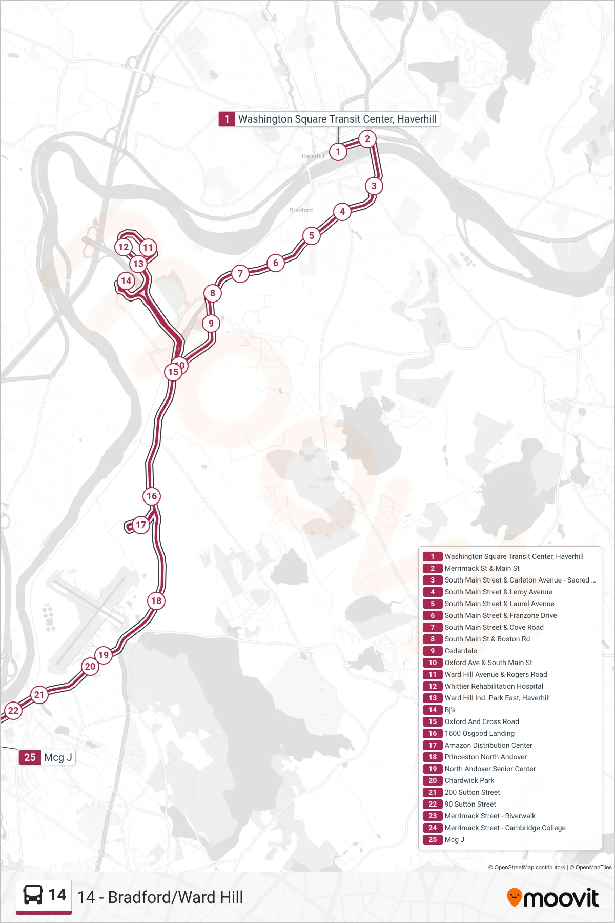
Stops list (14 - Outbound)
- Washington Square Transit Center, Haverhill
- Merrimack St & Main St
- South Main Street & Carleton Avenue - Sacred Hearts
- South Main Street & Leroy Avenue
- South Main Street & Laurel Avenue
- South Main Street & Franzone Drive
- South Main Street & Cove Road
- South Main St & Boston Rd
- Cedardale
- Oxford Ave & South Main St
- Ward Hill Avenue & Rogers Road
- Whittier Rehabilitation Hospital
- Ward Hill Ind. Park East, Haverhill
- Bj's
- Oxford And Cross Road
- 1600 Osgood Landing
- Amazon Distribution Center
- Princeston North Andover
- North Andover Senior Center
- Chardwick Park
- 200 Sutton Street
- 90 Sutton Street
- Merrimack Street - Riverwalk
- Merrimack Street - Cambridge College
- Mcg J