
14 Bus Route Map
View the 14 route map and see all 14 stops along the route. The map of 14 shows where the bus travels and the location of each stop, making it easy to understand the entire route at a glance.
Explore Bus Átha Cliath – Dublin Bus routes on the map and see where Bus Átha Cliath – Dublin Bus bus services operate. Use the 14 map to find bus stops and see how the 14 connects different areas along its trip.
All 14 stops on the map are displayed in route order, helping you follow the 14 bus from the first stop to the last.
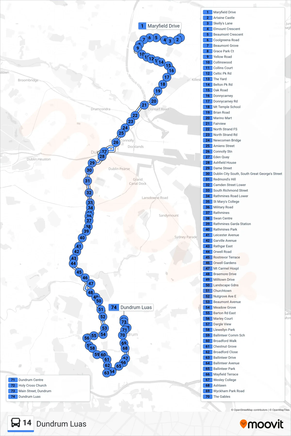
Stops list (14 - Dundrum Luas)
- Maryfield Drive
- Artaine Castle
- Skelly's Lane
- Elmount Crescent
- Beaumont Crescent
- Coolgreena Road
- Beaumont Grove
- Grace Park Ct
- Yellow Road
- Collinswood
- Collins Court
- Celtic Pk Rd
- The Yard
- Belton Pk Rd
- Oak Road
- Donnycarney
- Donnycarney Rd
- Mt Temple School
- Brian Road
- Marino Mart
- Fairview
- North Strand FS
- North Strand Rd
- Newcomen Bridge
- Amiens Street
- Connolly Stn
- Eden Quay
- Ashfield House
- Dame Street
- Dublin City South, South Great George's Street
- Redmond's Hill
- Camden Street Lower
- South Richmond Street
- Rathmines Road Lower
- St Mary's College
- Military Road
- Rathmines
- Swan Centre
- Rathmines Garda Station
- Rathmines Park
- Leicester Avenue
- Garville Avenue
- Rathgar East
- Orwell Road
- Rostrevor Terrace
- Orwell Gardens
- Mt Carmel Hospl
- Braemore Drive
- Milltown Drive
- Landscape Gdns
- Churchtown
- Nutgrove Ave E
- Beaumont Avenue
- Meadow Grove
- Barton Rd East
- Marley Court
- Dargle View
- Llewellyn Park
- Ballinteer Comm Sch
- Broadford Walk
- Chestnut Grove
- Broadford Close
- Ballinteer Drive
- Ballinteer Avenue
- Ballinteer Park
- Mayfield Terrace
- Wesley College
- Ashlawn
- Wyckham Park Road
- The Gables
- Dundrum Centre
- Holy Cross Church
- Main Street, Dundrum
- Dundrum Luas