
14 Bus Route Map
View the 14 route map and see all 14 stops along the route. The map of 14 shows where the bus travels and the location of each stop, making it easy to understand the entire route at a glance.
Explore Metropoline routes on the map and see where Metropoline bus services operate. Use the 14 map to find bus stops and see how the 14 connects different areas along its trip.
All 14 stops on the map are displayed in route order, helping you follow the 14 bus from the first stop to the last.
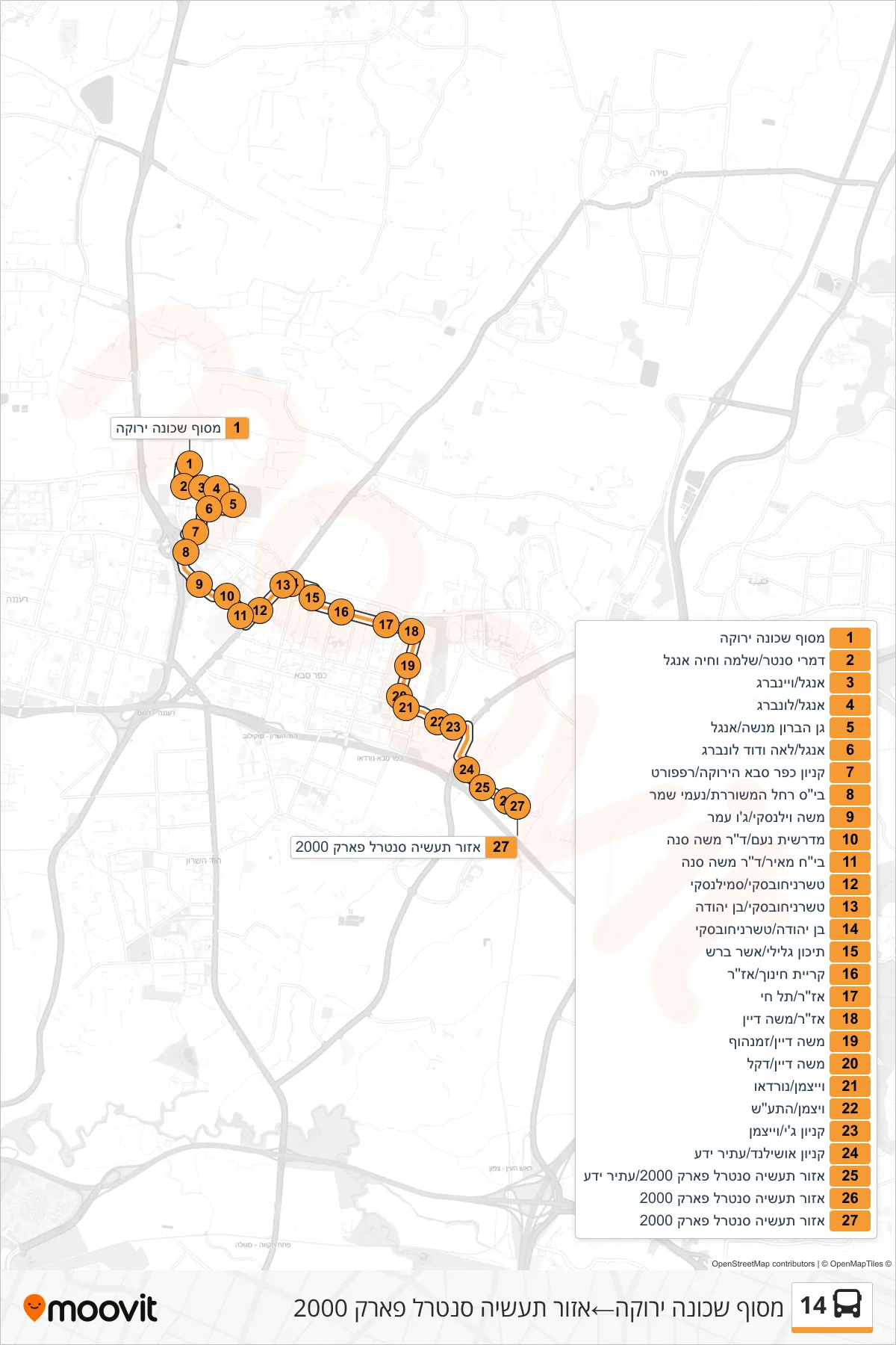
Stops list (14 - Green Neighborhood Terminal→Central Park 2000 Industrial Zone)
- Green Neighborhood Terminal
- Damri Center/Shlomo and Haya Engel
- Engel/Weinberg
- Engel/Lunberg
- Baron Menashe Garden/Engel
- Engel/Leah and David Lonberg
- Kfar Saba Green Mall/Rappaport
- Rachel the Poet School/Naomi Shemer
- Moshe Wilensky/Joe Amar
- Noam Seminary/Dr. Moshe Sneh
- Meir Hospital/Dr. Moshe Sneh
- Tchernichovsky/Smilansky
- Tchernichovsky/Ben Yehuda
- Ben Yehuda/Tchernichovsky
- Galili High School/Asher Barash
- Education Campus/Azar
- Azar/Tel Hai
- Azar/Moshe Dayan
- Moshe Dayan/Zamenhof
- Moshe Dayan/Dekel
- Weizmann/Nordau
- Weizmann/HaTaas
- G Mall/Weizmann
- Oshiland Mall/Atir Yeda
- Industrial Zone Central Park 2000/Atir Yeda
- Central Park 2000 Industrial Zone
- Central Park 2000 Industrial Zone