
14 Trolleybus Route Map
View the 14 route map and see all 14 stops along the route. The map of 14 shows where the Trolleybus travels and the location of each stop, making it easy to understand the entire route at a glance.
Explore KP Kyivpastrans routes on the map and see where KP Kyivpastrans Trolleybus services operate. Use the 14 map to find Trolleybus stations and see how the 14 connects different areas along its trip.
All 14 stops on the map are displayed in route order, helping you follow the 14 Trolleybus from the first station to the last.
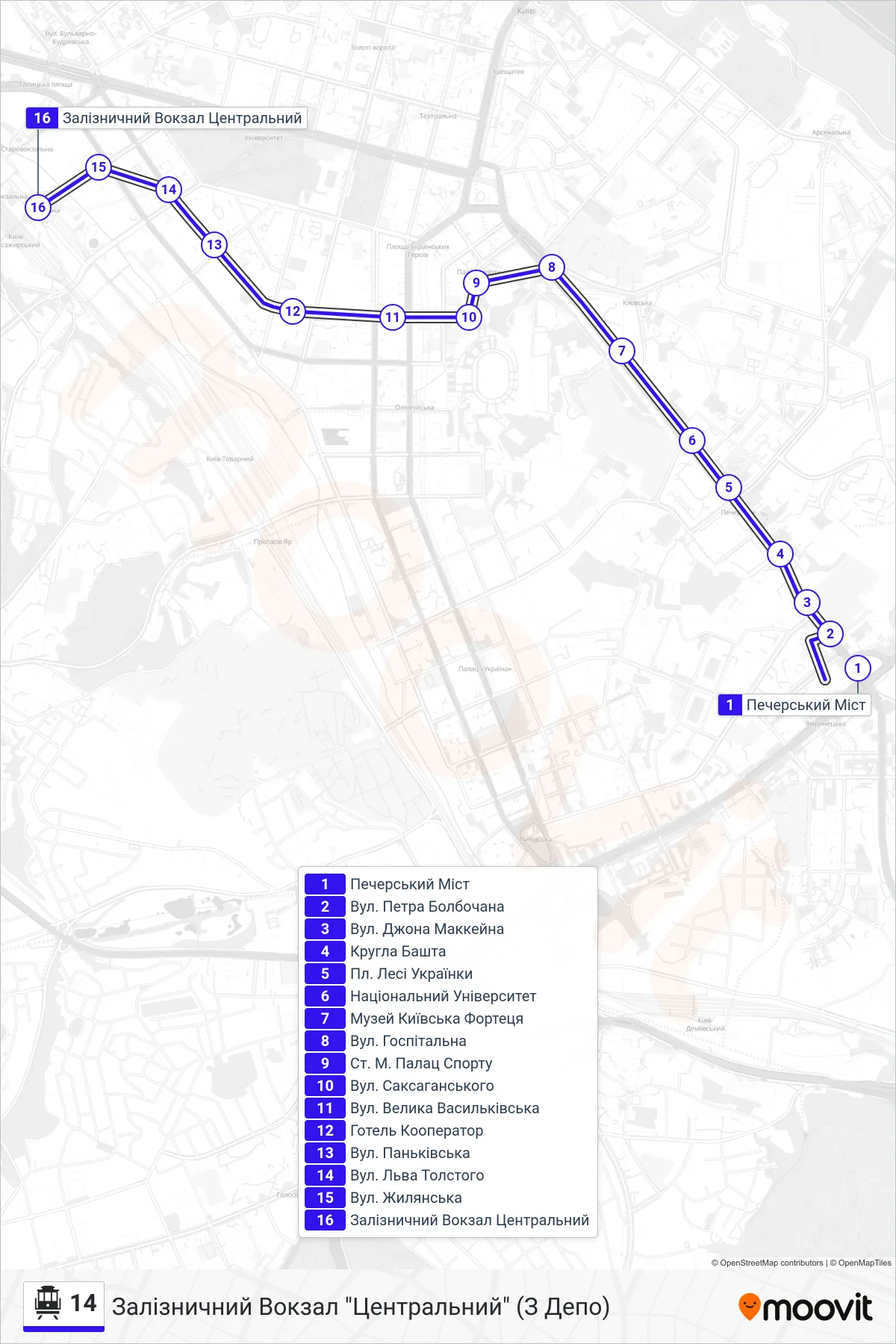
Stops list (14 - Central Railway Station (From Depot))
- Pechersk Bridge
- Petro Bolbochan Street
- John McCain St
- Round Tower
- Lesya Ukrainka Square
- National University
- Kyiv Fortress Museum
- Hospital Street
- Palace of Sports Metro Station
- Saksahanskoho Street
- Velyka Vasylkivska St
- Hotel Kooperator
- Pankivska Street
- Leo Tolstoy Street
- Zhylianska St
- Central Railway Station