
14 Tram Route Map
View the 14 route map and see all 14 stops along the route. The map of 14 shows where the tram travels and the location of each stop, making it easy to understand the entire route at a glance.
Explore KP Kyivpastrans routes on the map and see where KP Kyivpastrans tram services operate. Use the 14 map to find tram stations and see how the 14 connects different areas along its trip.
All 14 stops on the map are displayed in route order, helping you follow the 14 tram from the first station to the last.
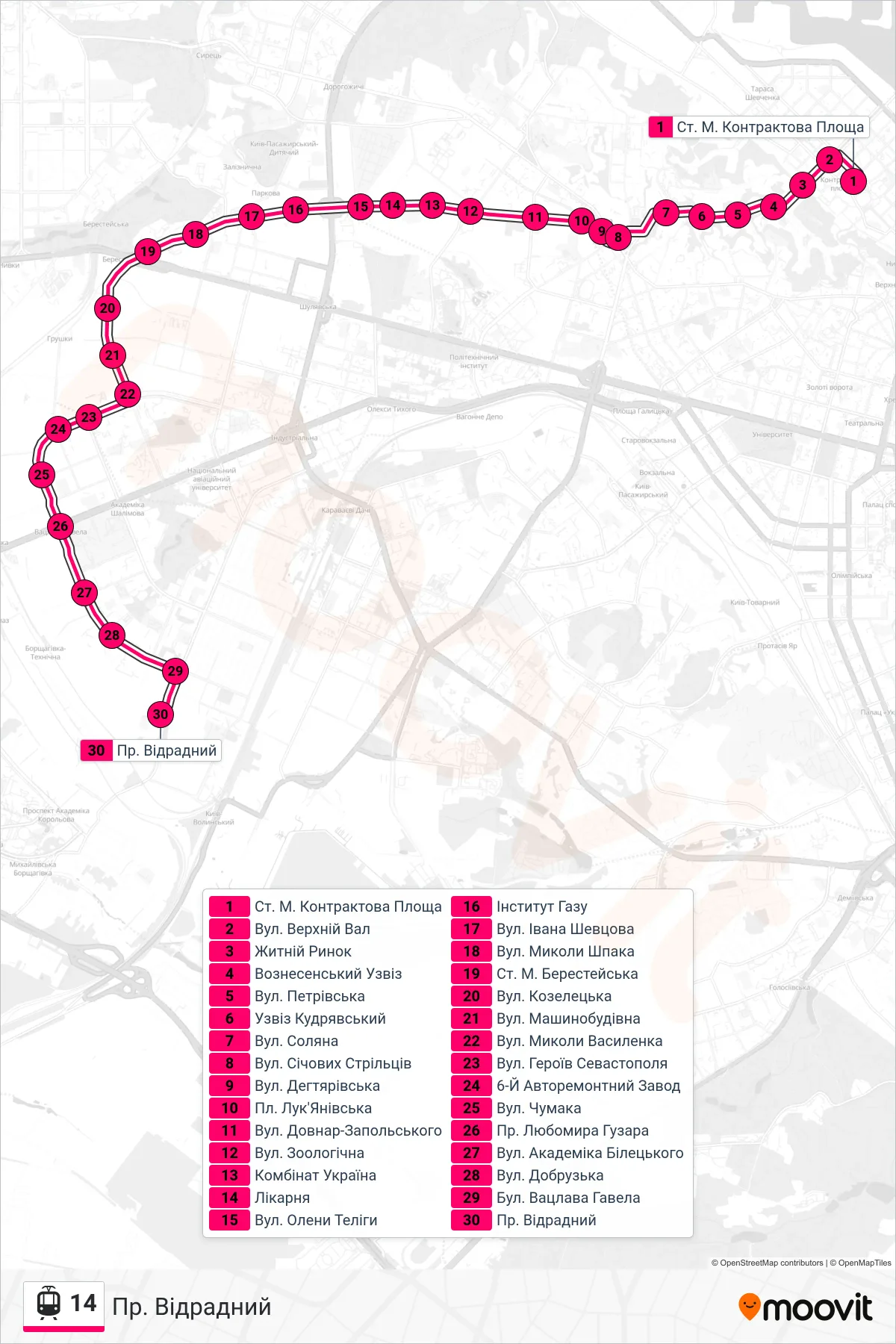
Stops list (14 - Vidradnyi Ave)
- Kontraktova Ploshcha Metro Station
- Verkhniy Val Street
- Zhytniy Market
- Voznesenskyi Descent
- Petrivska Street
- Kudriavskyi Descent
- Soliana Street
- Sichovykh Striltsiv Street
- Dehtiarska Street
- Lukianivska Square
- Dovnar-Zapolskyi St
- Zoolohichna Street
- Kombinat Ukraine
- Hospital
- Oleny Telihy Street
- Gas Institute
- Ivan Shevtsov Street
- Mykoly Shpaka Street
- Beresteiska Metro Station
- Kozeletska Street
- Mashynobudivna Street
- Mykoly Vasylenka Street
- Heroes of Sevastopol Street
- 6th Auto Repair Plant
- Chumaka Street
- Lubomyr Huzar Avenue
- Academician Biletskyi Street
- Dobruzka Street
- Vaclav Havel Boulevard
- Vidradnyi Ave