
14 Bus Route Map
View the 14 route map and see all 14 stops along the route. The map of 14 shows where the bus travels and the location of each stop, making it easy to understand the entire route at a glance.
Explore Brodschelm Linie routes on the map and see where Brodschelm Linie bus services operate. Use the 14 map to find bus stops and see how the 14 connects different areas along its trip.
All 14 stops on the map are displayed in route order, helping you follow the 14 bus from the first stop to the last.
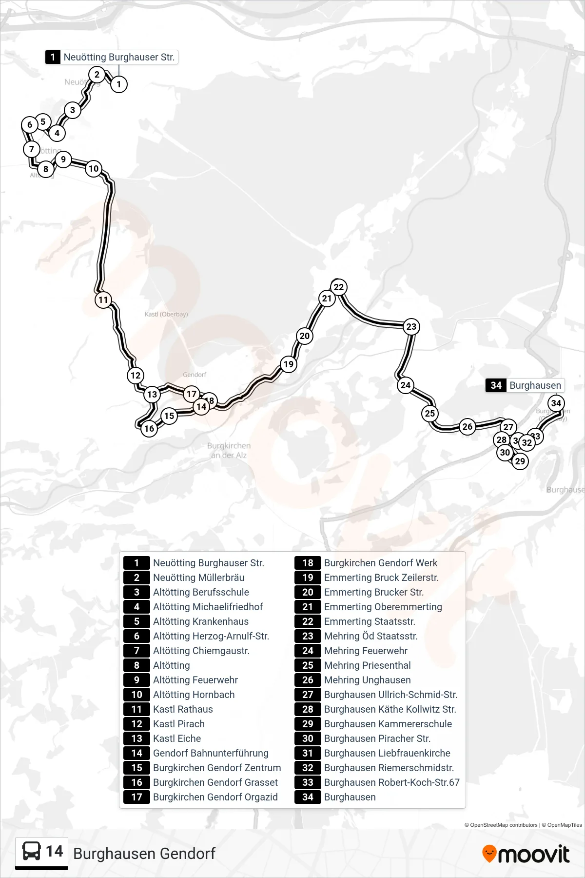
Stops list (14 - Burghausen Gendorf)
- Neuötting Burghauser Str.
- Neuötting Müllerbräu
- Altötting Berufsschule
- Altötting Michaelifriedhof
- Altötting Krankenhaus
- Altötting Herzog-Arnulf-Str.
- Altötting Chiemgaustr.
- Altötting
- Altötting Feuerwehr
- Altötting Hornbach
- Kastl Rathaus
- Kastl Pirach
- Kastl Eiche
- Gendorf Bahnunterführung
- Burgkirchen Gendorf Zentrum
- Burgkirchen Gendorf Grasset
- Burgkirchen Gendorf Orgazid
- Burgkirchen Gendorf Werk
- Emmerting Bruck Zeilerstr.
- Emmerting Brucker Str.
- Emmerting Oberemmerting
- Emmerting Staatsstr.
- Mehring Öd Staatsstr.
- Mehring Feuerwehr
- Mehring Priesenthal
- Mehring Unghausen
- Burghausen Ullrich-Schmid-Str.
- Burghausen Käthe Kollwitz Str.
- Burghausen Kammererschule
- Burghausen Piracher Str.
- Burghausen Liebfrauenkirche
- Burghausen Riemerschmidstr.
- Burghausen Robert-Koch-Str.67
- Burghausen
Change direction
- Route Map - 14 - Burghausen Wacker
- Route Map - 14 - Burghausen Kurs 32
- Route Map - 14 - Altötting\Nweiter Nach Burghausen
- Route Map - 14 - Gendorf
- Route Map - 14 - Altötting
- Route Map - 14 - Mehring
- Route Map - 14 - Altötting\Nmontessori
- Route Map - 14 - Emmerting
- Route Map - 14 - Neuötting
- Route Map - 14 - Unterneukirchen\Ngendorf
- Route Map - 14 - Burghausen Kurs 26
- Route Map - 14 - Altötting Weiß-Ferdl-Schule
- Route Map - 14 - Burghausen Marktler Str.
- Route Map - 14 - Rufbus Nach Burghausen
- Route Map - 14 - Burghausen Kurs 22
- Route Map - 14 - Emmerting\Nmehring
- Route Map - 14 - Neuötting\Nalzgern
- Route Map - 14 - Haiming
- Route Map - 14 - Altötting Feuerwehr
- Route Map - 14 - Burghausen Kurs 28
- Route Map - 14 - Burghausen
- Route Map - 14 - Altötting\Nemmerting