
14 Bus Route Map
View the 14 route map and see all 14 stops along the route. The map of 14 shows where the bus travels and the location of each stop, making it easy to understand the entire route at a glance.
Explore GoRaleigh routes on the map and see where GoRaleigh bus services operate. Use the 14 map to find bus stops and see how the 14 connects different areas along its trip.
All 14 stops on the map are displayed in route order, helping you follow the 14 bus from the first stop to the last.
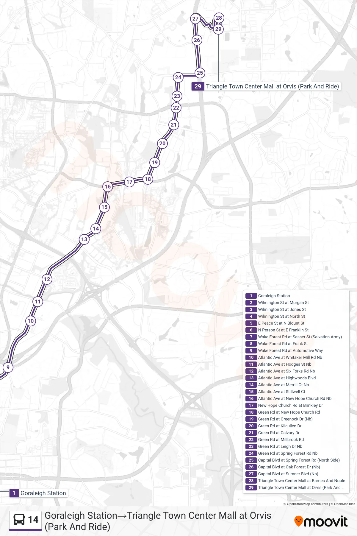
Stops list (14 - Goraleigh Station→Triangle Town Center Mall at Orvis (Park And Ride))
- Goraleigh Station
- Wilmington St at Morgan St
- Wilmington St at Jones St
- Wilmington St at North St
- E Peace St at N Blount St
- N Person St at E Franklin St
- Wake Forest Rd at Sasser St (Salvation Army)
- Wake Forest Rd at Frank St
- Wake Forest Rd at Automotive Way
- Atlantic Ave at Whitaker Mill Rd Nb
- Atlantic Ave at Hodges St Nb
- Atlantic Ave at Six Forks Rd Nb
- Atlantic Ave at Highwoods Blvd
- Atlantic Ave at Merrill Ct Nb
- Atlantic Ave at Stillwell Ct
- Atlantic Ave at New Hope Church Rd Nb
- New Hope Church Rd at Brinkley Dr
- Green Rd at New Hope Church Rd
- Green Rd at Greenock Dr (Nb)
- Green Rd at Kilcullen Dr
- Green Rd at Calvary Dr
- Green Rd at Millbrook Rd
- Green Rd at Leigh Dr Nb
- Green Rd at Spring Forest Rd Nb
- Capital Blvd at Spring Forest Rd (North Side)
- Capital Blvd at Oak Forest Dr (Nb)
- Capital Blvd at Sumner Blvd (Nb)
- Triangle Town Center Mall at Barnes And Noble
- Triangle Town Center Mall at Orvis (Park And Ride)