
14 Bus Route Map
View the 14 route map and see all 14 stops along the route. The map of 14 shows where the bus travels and the location of each stop, making it easy to understand the entire route at a glance.
Explore STAR routes on the map and see where STAR bus services operate. Use the 14 map to find bus stops and see how the 14 connects different areas along its trip.
All 14 stops on the map are displayed in route order, helping you follow the 14 bus from the first stop to the last.
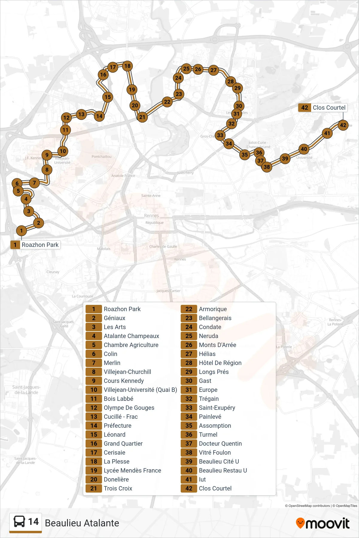
Stops list (14 - Beaulieu Atalante)
- Roazhon Park
- Géniaux
- Les Arts
- Atalante Champeaux
- Chambre Agriculture
- Colin
- Merlin
- Villejean-Churchill
- Cours Kennedy
- Villejean-Université (Quai B)
- Bois Labbé
- Olympe De Gouges
- Cucillé - Frac
- Préfecture
- Léonard
- Grand Quartier
- Cerisaie
- La Plesse
- Lycée Mendès France
- Donelière
- Trois Croix
- Armorique
- Bellangerais
- Condate
- Neruda
- Monts D'Arrée
- Hélias
- Hôtel De Région
- Longs Prés
- Gast
- Europe
- Trégain
- Saint-Exupéry
- Painlevé
- Assomption
- Turmel
- Docteur Quentin
- Vitré Foulon
- Beaulieu Cité U
- Beaulieu Restau U
- Iut
- Clos Courtel