
14 Bus Route Map
View the 14 route map and see all 14 stops along the route. The map of 14 shows where the bus travels and the location of each stop, making it easy to understand the entire route at a glance.
Explore Aachener Straßenbahn- und Energieversorgungs-AG routes on the map and see where Aachener Straßenbahn- und Energieversorgungs-AG bus services operate. Use the 14 map to find bus stops and see how the 14 connects different areas along its trip.
All 14 stops on the map are displayed in route order, helping you follow the 14 bus from the first stop to the last.
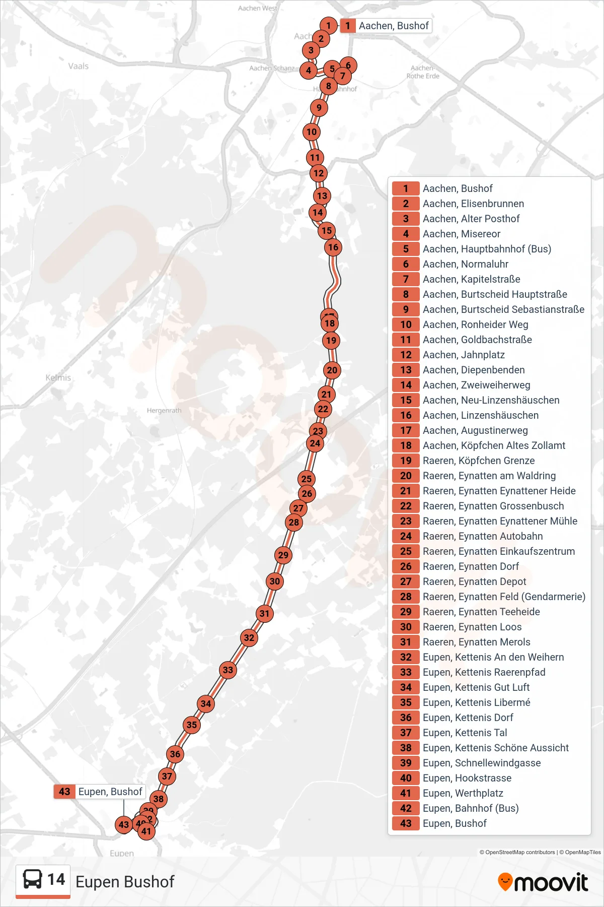
Stops list (14 - Eupen Bushof)
- Aachen, Bushof
- Aachen, Elisenbrunnen
- Aachen, Alter Posthof
- Aachen, Misereor
- Aachen, Hauptbahnhof (Bus)
- Aachen, Normaluhr
- Aachen, Ronheider Weg
- Aachen, Goldbachstraße
- Aachen, Jahnplatz
- Aachen, Diepenbenden
- Aachen, Zweiweiherweg
- Aachen, Neu-Linzenshäuschen
- Aachen, Linzenshäuschen
- Aachen, Augustinerweg
- Aachen, Köpfchen Altes Zollamt
- Raeren, Köpfchen Grenze
- Raeren, Eynatten am Waldring
- Raeren, Eynatten Eynattener Heide
- Raeren, Eynatten Grossenbusch
- Raeren, Eynatten Eynattener Mühle
- Raeren, Eynatten Autobahn
- Raeren, Eynatten Einkaufszentrum
- Raeren, Eynatten Dorf
- Raeren, Eynatten Depot
- Raeren, Eynatten Feld (Gendarmerie)
- Raeren, Eynatten Teeheide
- Raeren, Eynatten Loos
- Raeren, Eynatten Merols
- Eupen, Kettenis An den Weihern
- Eupen, Kettenis Raerenpfad
- Eupen, Kettenis Gut Luft
- Eupen, Kettenis Libermé
- Eupen, Kettenis Dorf
- Eupen, Kettenis Tal
- Eupen, Kettenis Schöne Aussicht
- Eupen, Schnellewindgasse
- Eupen, Hookstrasse
- Eupen, Werthplatz
- Eupen, Bahnhof (Bus)
- Eupen, Bushof