
14 Bus Route Map
View the 14 route map and see all 14 stops along the route. The map of 14 shows where the bus travels and the location of each stop, making it easy to understand the entire route at a glance.
Explore ASTRAL routes on the map and see where ASTRAL bus services operate. Use the 14 map to find bus stops and see how the 14 connects different areas along its trip.
All 14 stops on the map are displayed in route order, helping you follow the 14 bus from the first stop to the last.
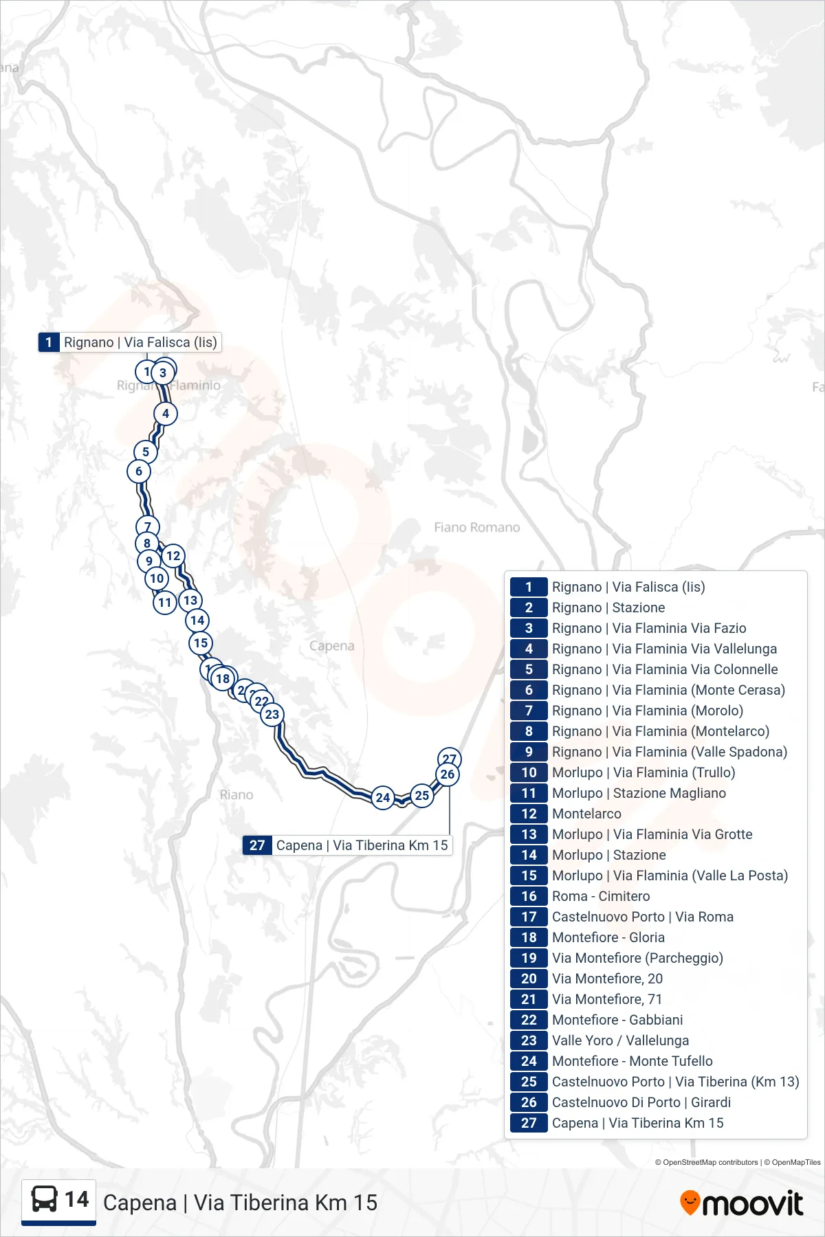
Stops list (14 - Capena | Tiberina Road Km 15)
- Rignano via Falisca (IIS)
- Rignano | Station
- Rignano | Flaminia Street Fazio Street
- Rignano | Via Flaminia Via Vallelunga
- Rignano | Flaminia Street Colonnelle Street
- Rignano | Flaminia St (Monte Cerasa)
- Rignano | Flaminia Street (Morolo)
- Rignano | Via Flaminia (Montelarco)
- Rignano | Flaminian Way (Spadona Valley)
- Morlupo | Flaminia Road (Trullo)
- Morlupo | Magliano Station
- Montelarco
- Morlupo | Via Flaminia Via Grotte
- Morlupo Station
- Morlupo | Flaminia Street (Valle La Posta)
- Rome - Cemetery
- Castelnuovo Porto | Roma Street
- Montefiore - Gloria
- Montefiore Street (Parking)
- Montefiore Street, 20
- Montefiore Road, 71
- Montefiore - Gabbiani
- Valle Yoro / Vallelunga
- Montefiore - Monte Tufello
- Castelnuovo Porto | Tiberina Road (Km 13)
- Castelnuovo Di Porto via Girardi
- Capena | Tiberina Road Km 15