
14 Bus Route Map
View the 14 route map and see all 14 stops along the route. The map of 14 shows where the bus travels and the location of each stop, making it easy to understand the entire route at a glance.
Explore Astuce (Métropole Rouen Normandie) routes on the map and see where Astuce (Métropole Rouen Normandie) bus services operate. Use the 14 map to find bus stops and see how the 14 connects different areas along its trip.
All 14 stops on the map are displayed in route order, helping you follow the 14 bus from the first stop to the last.
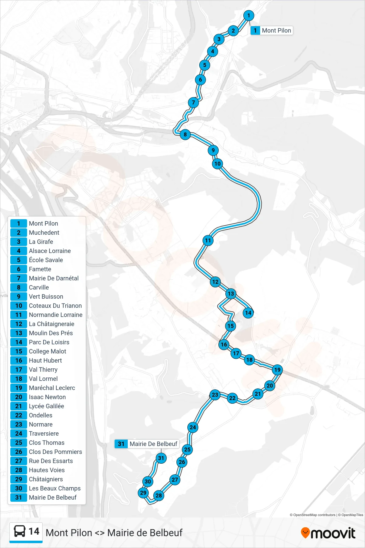
Stops list (14 - Mairie Belbeuf)
- Mont Pilon
- Muchedent
- La Girafe
- Alsace Lorraine
- École Savale
- Famette
- Mairie De Darnétal
- Carville
- Vert Buisson
- Coteaux Du Trianon
- Normandie Lorraine
- La Châtaigneraie
- Moulin Des Prés
- Parc De Loisirs
- College Malot
- Haut Hubert
- Val Thierry
- Val Lormel
- Maréchal Leclerc
- Isaac Newton
- Lycée Galilée
- Ondelles
- Normare
- Traversiere
- Clos Thomas
- Clos Des Pommiers
- Rue Des Essarts
- Hautes Voies
- Châtaigniers
- Les Beaux Champs
- Mairie De Belbeuf