
14 Bus Route Map
View the 14 route map and see all 14 stops along the route. The map of 14 shows where the bus travels and the location of each stop, making it easy to understand the entire route at a glance.
Explore AC Transit routes on the map and see where AC Transit bus services operate. Use the 14 map to find bus stops and see how the 14 connects different areas along its trip.
All 14 stops on the map are displayed in route order, helping you follow the 14 bus from the first stop to the last.
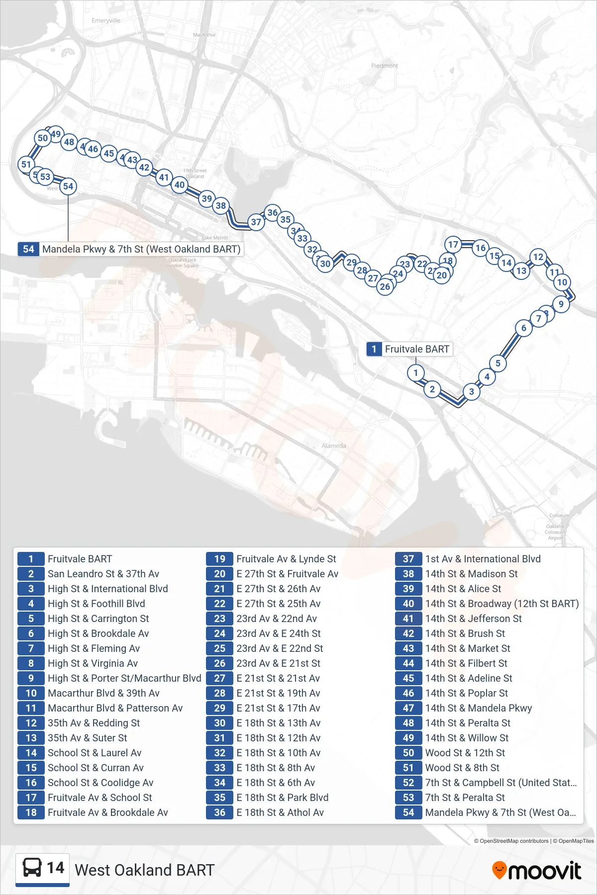
Stops list (14 - West Oakland BART)
- Fruitvale BART
- San Leandro St & 37th Av
- High St & International Blvd
- High St & Foothill Blvd
- High St & Carrington St
- High St & Brookdale Av
- High St & Fleming Av
- High St & Virginia Av
- High St & Porter St/Macarthur Blvd
- Macarthur Blvd & 39th Av
- Macarthur Blvd & Patterson Av
- 35th Av & Redding St
- 35th Av & Suter St
- School St & Laurel Av
- School St & Curran Av
- School St & Coolidge Av
- Fruitvale Av & School St
- Fruitvale Av & Brookdale Av
- Fruitvale Av & Lynde St
- E 27th St & Fruitvale Av
- E 27th St & 26th Av
- E 27th St & 25th Av
- 23rd Av & 22nd Av
- 23rd Av & E 24th St
- 23rd Av & E 22nd St
- 23rd Av & E 21st St
- E 21st St & 21st Av
- E 21st St & 19th Av
- E 21st St & 17th Av
- E 18th St & 13th Av
- E 18th St & 12th Av
- E 18th St & 10th Av
- E 18th St & 8th Av
- E 18th St & 6th Av
- E 18th St & Park Blvd
- E 18th St & Athol Av
- 1st Av & International Blvd
- 14th St & Madison St
- 14th St & Alice St
- 14th St & Broadway (12th St BART)
- 14th St & Jefferson St
- 14th St & Brush St
- 14th St & Market St
- 14th St & Filbert St
- 14th St & Adeline St
- 14th St & Poplar St
- 14th St & Mandela Pkwy
- 14th St & Peralta St
- 14th St & Willow St
- Wood St & 12th St
- Wood St & 8th St
- 7th St & Campbell St (United States Post Office)
- 7th St & Peralta St
- Mandela Pkwy & 7th St (West Oakland BART)