
14 Bus Route Map
View the 14 route map and see all 14 stops along the route. The map of 14 shows where the bus travels and the location of each stop, making it easy to understand the entire route at a glance.
Explore County Connection routes on the map and see where County Connection bus services operate. Use the 14 map to find bus stops and see how the 14 connects different areas along its trip.
All 14 stops on the map are displayed in route order, helping you follow the 14 bus from the first stop to the last.
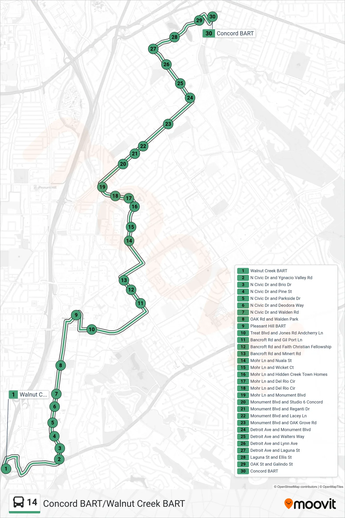
Stops list (14 - Concord BART via Pleasant Hill BART)
- Walnut Creek BART
- N Civic Dr and Ygnacio Valley Rd
- N Civic Dr and Brio Dr
- N Civic Dr and Pine St
- N Civic Dr and Parkside Dr
- N Civic Dr and Deodora Way
- N Civic Dr and Walden Rd
- OAK Rd and Walden Park
- Pleasant Hill BART
- Treat Blvd and Jones Rd Andcherry Ln
- Bancroft Rd and Gil Port Ln
- Bancroft Rd and Faith Christian Fellowship
- Bancroft Rd and Minert Rd
- Mohr Ln and Nuala St
- Mohr Ln and Wicket Ct
- Mohr Ln and Hidden Creek Town Homes
- Mohr Ln and Del Rio Cir
- Mohr Ln and Del Rio Cir
- Mohr Ln and Monument Blvd
- Monument Blvd and Studio 6 Concord
- Monument Blvd and Reganti Dr
- Monument Blvd and Lacey Ln
- Monument Blvd and OAK Grove Rd
- Detroit Ave and Monument Blvd
- Detroit Ave and Walters Way
- Detroit Ave and Lynn Ave
- Detroit Ave and Laguna St
- Laguna St and Ellis St
- OAK St and Galindo St
- Concord BART