
14 Bus Route Map
View the 14 route map and see all 14 stops along the route. The map of 14 shows where the bus travels and the location of each stop, making it easy to understand the entire route at a glance.
Explore GTT Suburban Service routes on the map and see where GTT Suburban Service bus services operate. Use the 14 map to find bus stops and see how the 14 connects different areas along its trip.
All 14 stops on the map are displayed in route order, helping you follow the 14 bus from the first stop to the last.
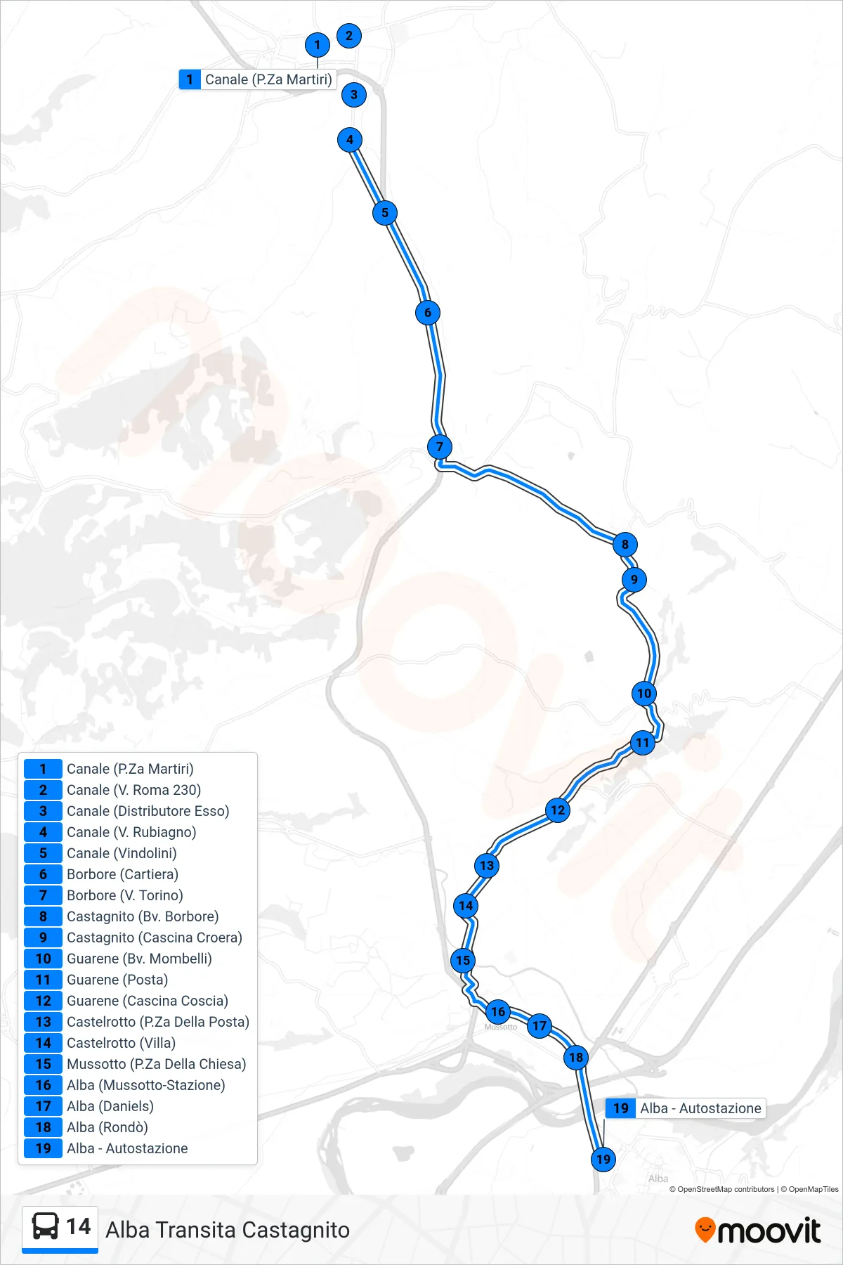
Stops list (14 - Alba via Castagnito)
- Canale (Martyrs Square)
- Canale (230 Roma St)
- Canale (Esso Gas Station)
- Canale (Rubiagno Street)
- Canale (Vindolini)
- Borbore (Paper Mill)
- Borbore (Via Torino)
- Castagnito (Borbore Junction)
- Castagnito (Croera Farm)
- Guarene (Mombelli Junction)
- Guarene (Post Office)
- Guarene (Coscia Farm)
- Castelrotto (Post Office Square)
- Castelrotto (Villa)
- Mussotto (Church Square)
- Alba (Mussotto-Station)
- Alba (Daniels)
- Alba (Roundabout)
- Alba - Bus Station
Change direction
- Route Map - 14 - Santo Stefano Roero
- Route Map - 14 - Poirino via Cellarengo
- Route Map - 14 - Poirino
- Route Map - 14 - Alba
- Route Map - 14 - Direct to Turin Piazza Carducci
- Route Map - 14 - Valle San Matteo via Vezza
- Route Map - 14 - Valpone
- Route Map - 14 - Turin Piazza Carducci
- Route Map - 14 - Channel
- Route Map - 14 - Monta
- Route Map - 14 - Channel
- Route Map - 14 - Turin Corso Tazzoli
- Route Map - 14 - Pralormo
- Route Map - 14 - Berteri
- Route Map - 14 - Poirino via Trofarello