
14 Bus Route Map
View the 14 route map and see all 14 stops along the route. The map of 14 shows where the bus travels and the location of each stop, making it easy to understand the entire route at a glance.
Explore Bay Area Transportation Authority routes on the map and see where Bay Area Transportation Authority bus services operate. Use the 14 map to find bus stops and see how the 14 connects different areas along its trip.
All 14 stops on the map are displayed in route order, helping you follow the 14 bus from the first stop to the last.
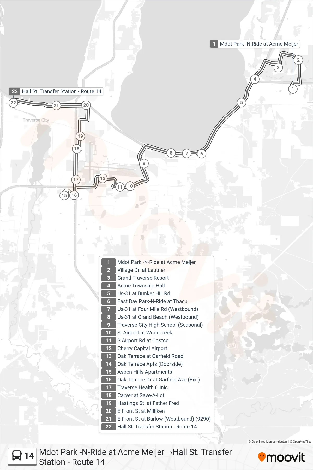
Stops list (14 - Mdot Park -N-Ride at Acme Meijer→Hall St. Transfer Station - Route 14)
- Mdot Park -N-Ride at Acme Meijer
- Village Dr. at Lautner
- Grand Traverse Resort
- Acme Township Hall
- Us-31 at Bunker Hill Rd
- East Bay Park-N-Ride at Tbacu
- Us-31 at Four Mile Rd (Westbound)
- Us-31 at Grand Beach (Westbound)
- Traverse City High School (Seasonal)
- S. Airport at Woodcreek
- S Airport Rd at Costco
- Cherry Capital Airport
- Oak Terrace at Garfield Road
- Oak Terrace Apts (Doorside)
- Aspen Hills Apartments
- Oak Terrace Dr at Garfield Ave (Exit)
- Traverse Health Clinic
- Carver at Save-A-Lot
- Hastings St. at Father Fred
- E Front St at Milliken
- E Front St at Barlow (Westbound) (9290)
- Hall St. Transfer Station - Route 14
Change direction
- Route Map - 14 - Rt 14 - Lafranier Transfer - Park-N-Ride→Hall St. Transfer Station - Route 14
- Route Map - 14 - Hall St. Transfer Station - Route 14→Rt 14 - Lafranier Transfer - Park-N-Ride
- Route Map - 14 - Hall St. Transfer Station - Route 14→Mdot Park -N-Ride at Acme Meijer
- Route Map - 14 - Mdot Park -N-Ride at Acme Meijer→Rt 14 - Lafranier Transfer - Park-N-Ride
- Route Map - 14 - Rt 14 - Lafranier Transfer - Park-N-Ride→Mdot Park -N-Ride at Acme Meijer
- Route Map - 14 - Mdot Park -N-Ride at Acme Meijer→East Bay Park-N-Ride at Tbacu
- Route Map - 14 - East Bay Park-N-Ride at Tbacu→Mdot Park -N-Ride at Acme Meijer