
14 Bus Route Map
View the 14 route map and see all 14 stops along the route. The map of 14 shows where the bus travels and the location of each stop, making it easy to understand the entire route at a glance.
Explore Montgomery County Ride On routes on the map and see where Montgomery County Ride On bus services operate. Use the 14 map to find bus stops and see how the 14 connects different areas along its trip.
All 14 stops on the map are displayed in route order, helping you follow the 14 bus from the first stop to the last.
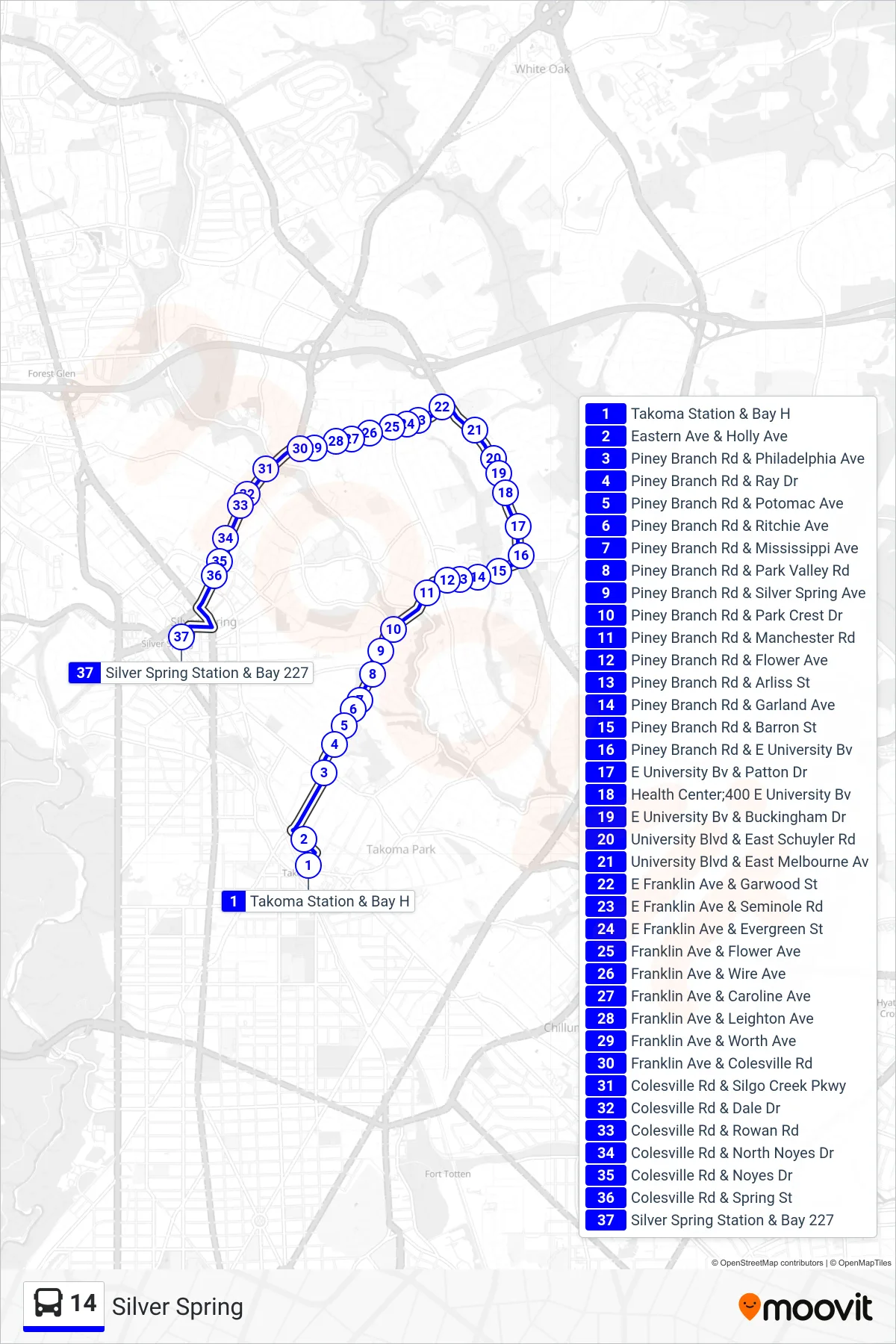
Stops list (14 - Silver Spring)
- Takoma Station & Bay H
- Eastern Ave & Holly Ave
- Piney Branch Rd & Philadelphia Ave
- Piney Branch Rd & Ray Dr
- Piney Branch Rd & Potomac Ave
- Piney Branch Rd & Ritchie Ave
- Piney Branch Rd & Mississippi Ave
- Piney Branch Rd & Park Valley Rd
- Piney Branch Rd & Silver Spring Ave
- Piney Branch Rd & Park Crest Dr
- Piney Branch Rd & Manchester Rd
- Piney Branch Rd & Flower Ave
- Piney Branch Rd & Arliss St
- Piney Branch Rd & Garland Ave
- Piney Branch Rd & Barron St
- Piney Branch Rd & E University Bv
- E University Bv & Patton Dr
- Health Center;400 E University Bv
- E University Bv & Buckingham Dr
- University Blvd & East Schuyler Rd
- University Blvd & East Melbourne Av
- E Franklin Ave & Garwood St
- E Franklin Ave & Seminole Rd
- E Franklin Ave & Evergreen St
- Franklin Ave & Flower Ave
- Franklin Ave & Wire Ave
- Franklin Ave & Caroline Ave
- Franklin Ave & Leighton Ave
- Franklin Ave & Worth Ave
- Franklin Ave & Colesville Rd
- Colesville Rd & Silgo Creek Pkwy
- Colesville Rd & Dale Dr
- Colesville Rd & Rowan Rd
- Colesville Rd & North Noyes Dr
- Colesville Rd & Noyes Dr
- Colesville Rd & Spring St
- Silver Spring Station & Bay 227