
140 Bus Route Map
View the 140 route map and see all 140 stops along the route. The map of 140 shows where the bus travels and the location of each stop, making it easy to understand the entire route at a glance.
Explore Metropoline routes on the map and see where Metropoline bus services operate. Use the 140 map to find bus stops and see how the 140 connects different areas along its trip.
All 140 stops on the map are displayed in route order, helping you follow the 140 bus from the first stop to the last.
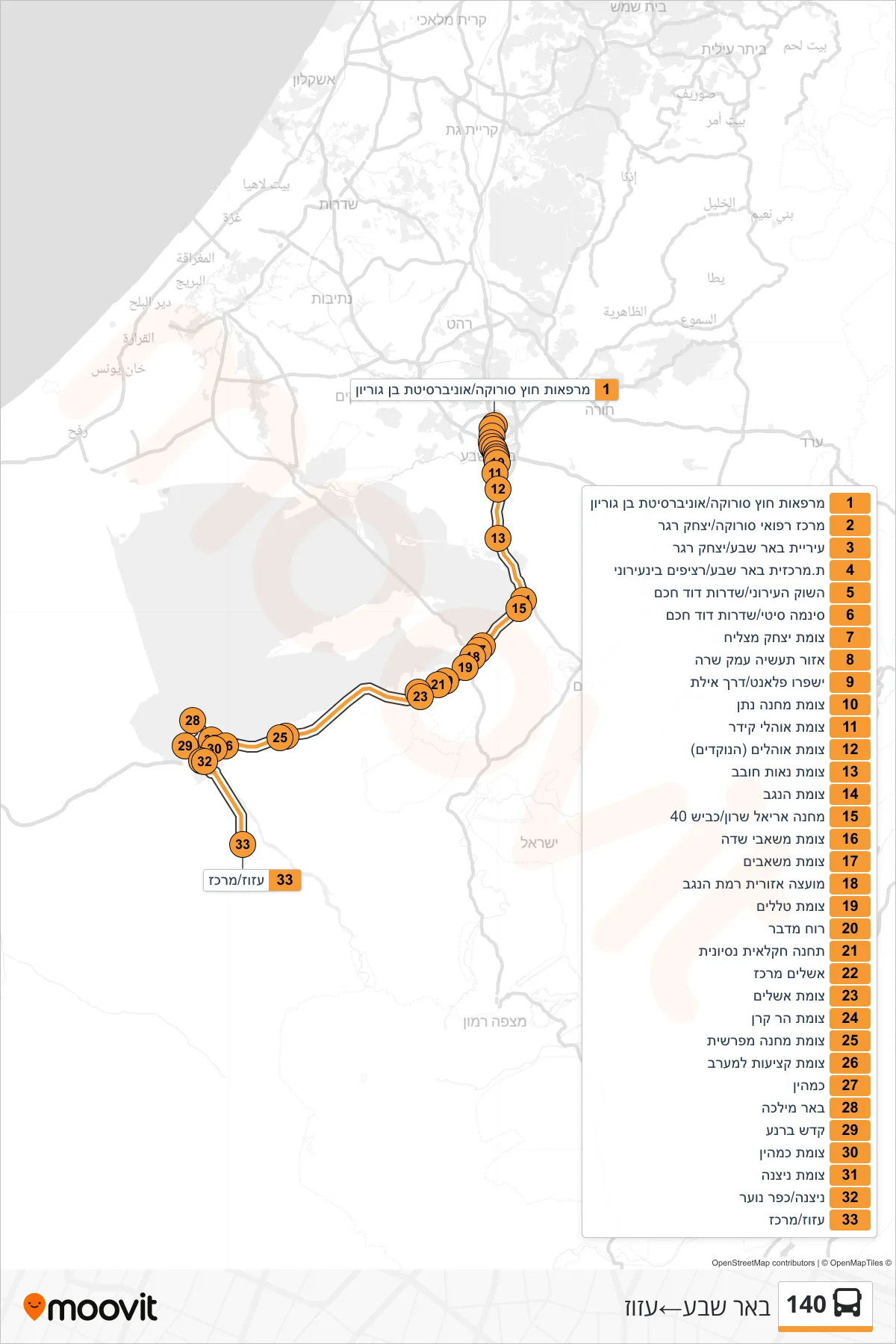
Stops list (140 - Beer Sheva→Ezuz)
- Soroka Outpatient Clinics/Ben Gurion University
- Soroka Medical Center/Yitzhak Rager
- Beer Sheva City Hall/Yitzhak Rager
- Beer Sheva Central Station/Intercity Platforms
- City Market/David Hacham Boulevard
- Cinema City/David Hacham Boulevard
- Yitzhak Matzliach Junction
- Emek Sara Industrial Zone
- Ispro Planet/Eilat Road
- Nathan Camp Junction
- Ohalei Kedar Junction
- Ohalim Junction (HaNokdim)
- Ne'ot Hovav Junction
- HaNegev Junction
- Camp Ariel Sharon/Road 40
- Mashabe Sade Junction
- Mashabim Junction
- Ramat Negev Regional Council
- Telalim Junction
- Desert Wind
- Agricultural Experiment Station
- Ashalim Center
- Ashalim Junction
- Mount Keren Junction
- Machane Mifrashit Junction
- Ketziot Junction West
- Kmehin
- Be'er Milka
- Kadesh Barnea
- Kmehin Junction
- Nitzana Junction
- Nitzana/Youth Village
- Azuz/Center