
141 Bus Route Map
View the 141 route map and see all 141 stops along the route. The map of 141 shows where the bus travels and the location of each stop, making it easy to understand the entire route at a glance.
Explore SamTrans routes on the map and see where SamTrans bus services operate. Use the 141 map to find bus stops and see how the 141 connects different areas along its trip.
All 141 stops on the map are displayed in route order, helping you follow the 141 bus from the first stop to the last.
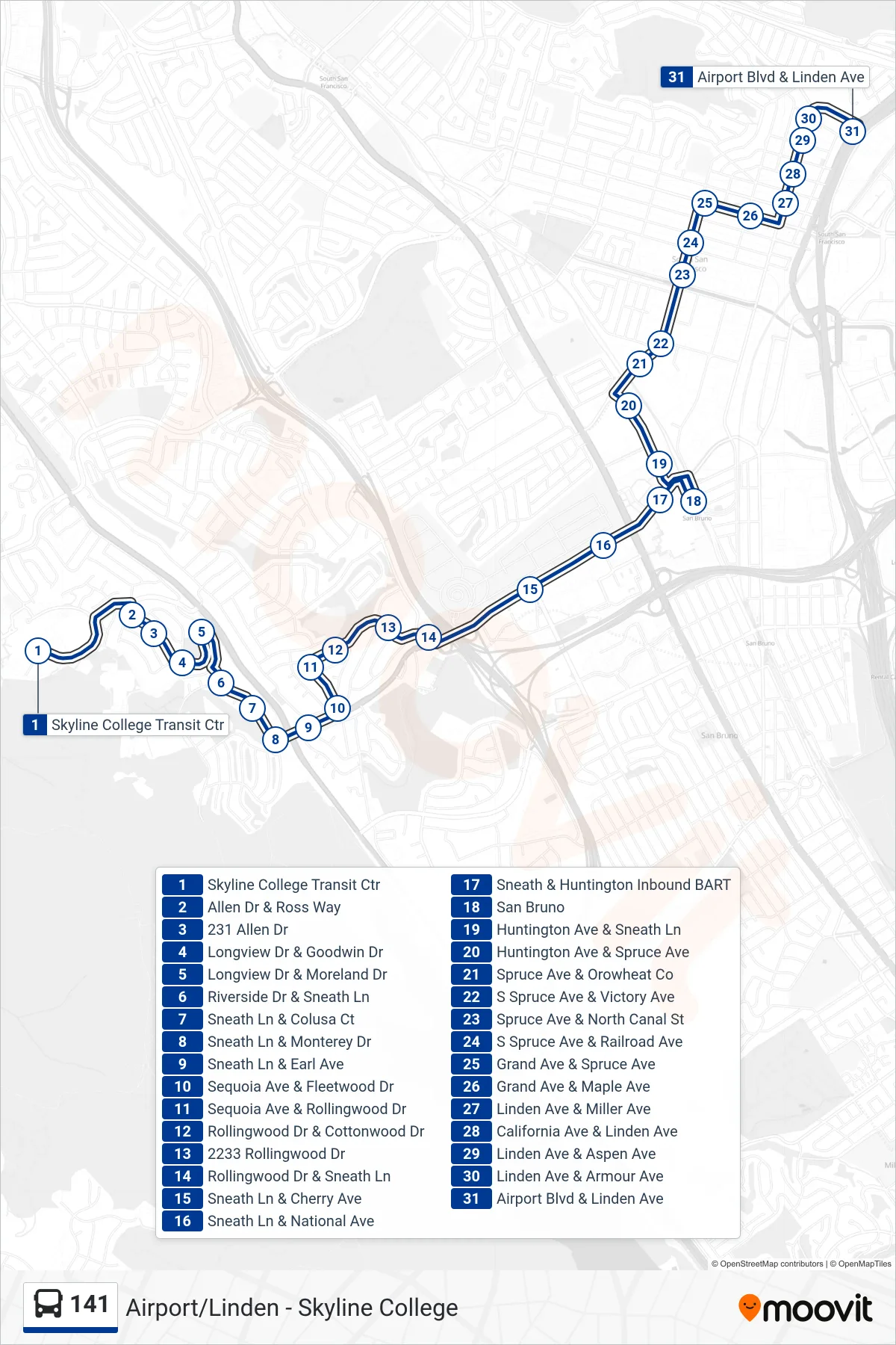
Stops list (141 - South San Francisco)
- Skyline College Transit Ctr
- Allen Dr & Ross Way
- 231 Allen Dr
- Longview Dr & Goodwin Dr
- Longview Dr & Moreland Dr
- Riverside Dr & Sneath Ln
- Sneath Ln & Colusa Ct
- Sneath Ln & Monterey Dr
- Sneath Ln & Earl Ave
- Sequoia Ave & Fleetwood Dr
- Sequoia Ave & Rollingwood Dr
- Rollingwood Dr & Cottonwood Dr
- 2233 Rollingwood Dr
- Rollingwood Dr & Sneath Ln
- Sneath Ln & Cherry Ave
- Sneath Ln & National Ave
- Sneath & Huntington Inbound BART
- San Bruno
- Huntington Ave & Sneath Ln
- Huntington Ave & Spruce Ave
- Spruce Ave & Orowheat Co
- S Spruce Ave & Victory Ave
- Spruce Ave & North Canal St
- S Spruce Ave & Railroad Ave
- Grand Ave & Spruce Ave
- Grand Ave & Maple Ave
- Linden Ave & Miller Ave
- California Ave & Linden Ave
- Linden Ave & Aspen Ave
- Linden Ave & Armour Ave
- Airport Blvd & Linden Ave