
142 Bus Route Map
View the 142 route map and see all 142 stops along the route. The map of 142 shows where the bus travels and the location of each stop, making it easy to understand the entire route at a glance.
Explore Bus Átha Cliath – Dublin Bus routes on the map and see where Bus Átha Cliath – Dublin Bus bus services operate. Use the 142 map to find bus stops and see how the 142 connects different areas along its trip.
All 142 stops on the map are displayed in route order, helping you follow the 142 bus from the first stop to the last.
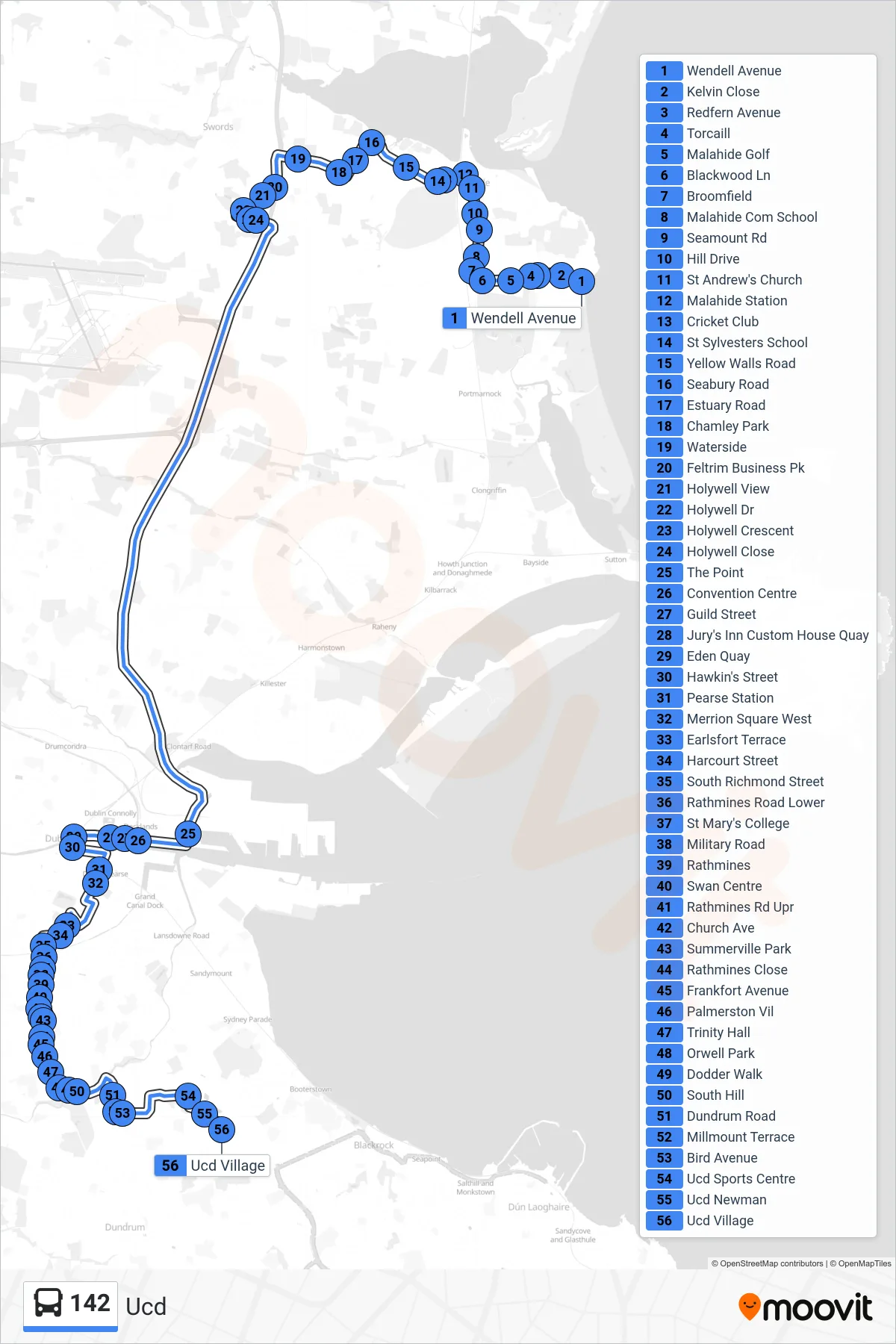
Stops list (142 - Ucd)
- Wendell Avenue
- Kelvin Close
- Redfern Avenue
- Torcaill
- Malahide Golf
- Blackwood Ln
- Broomfield
- Malahide Com School
- Seamount Rd
- Hill Drive
- St Andrew's Church
- Malahide Station
- Cricket Club
- St Sylvesters School
- Yellow Walls Road
- Seabury Road
- Estuary Road
- Chamley Park
- Waterside
- Feltrim Business Pk
- Holywell View
- Holywell Dr
- Holywell Crescent
- Holywell Close
- The Point
- Convention Centre
- Guild Street
- Jury's Inn Custom House Quay
- Eden Quay
- Hawkin's Street
- Pearse Station
- Merrion Square West
- Earlsfort Terrace
- Harcourt Street
- South Richmond Street
- Rathmines Road Lower
- St Mary's College
- Military Road
- Rathmines
- Swan Centre
- Rathmines Rd Upr
- Church Ave
- Summerville Park
- Rathmines Close
- Frankfort Avenue
- Palmerston Vil
- Trinity Hall
- Orwell Park
- Dodder Walk
- South Hill
- Dundrum Road
- Millmount Terrace
- Bird Avenue
- Ucd Sports Centre
- Ucd Newman
- Ucd Village