
143 Bus Route Map
View the 143 route map and see all 143 stops along the route. The map of 143 shows where the bus travels and the location of each stop, making it easy to understand the entire route at a glance.
Explore KVB Kölner Verkehrs-Betriebe AG routes on the map and see where KVB Kölner Verkehrs-Betriebe AG bus services operate. Use the 143 map to find bus stops and see how the 143 connects different areas along its trip.
All 143 stops on the map are displayed in route order, helping you follow the 143 bus from the first stop to the last.
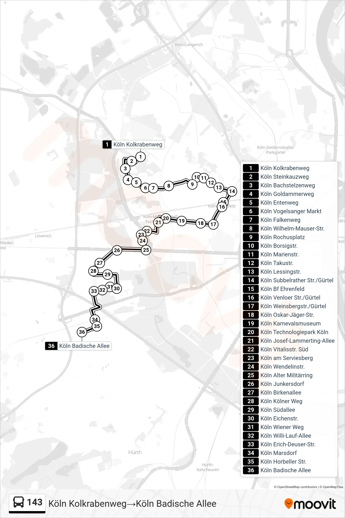
Stops list (143 - Köln Kolkrabenweg→Köln Badische Allee)
- Köln Kolkrabenweg
- Köln Steinkauzweg
- Köln Bachstelzenweg
- Köln Goldammerweg
- Köln Entenweg
- Köln Vogelsanger Markt
- Köln Falkenweg
- Köln Wilhelm-Mauser-Str.
- Köln Rochusplatz
- Köln Borsigstr.
- Köln Marienstr.
- Köln Takustr.
- Köln Lessingstr.
- Köln Subbelrather Str./Gürtel
- Köln Bf Ehrenfeld
- Köln Venloer Str./Gürtel
- Köln Weinsbergstr./Gürtel
- Köln Oskar-Jäger-Str.
- Köln Karnevalsmuseum
- Köln Technologiepark Köln
- Köln Josef-Lammerting-Allee
- Köln Vitalisstr. Süd
- Köln am Serviesberg
- Köln Wendelinstr.
- Köln Alter Militärring
- Köln Junkersdorf
- Köln Birkenallee
- Köln Kölner Weg
- Köln Südallee
- Köln Eichenstr.
- Köln Wiener Weg
- Köln Willi-Lauf-Allee
- Köln Erich-Deuser-Str.
- Köln Marsdorf
- Köln Horbeller Str.
- Köln Badische Allee
Change direction
- Route Map - 143 - Köln Gewerbegebiet Marsdorf→Köln Bocklemünd
- Route Map - 143 - Köln Badische Allee→Köln Kolkrabenweg
- Route Map - 143 - Köln Bocklemünd→Köln Gewerbegebiet Marsdorf
- Route Map - 143 - Köln Gewerbegebiet Marsdorf→Köln Kolkrabenweg
- Route Map - 143 - Köln Gewerbegebiet Marsdorf→Köln Junkersdorf
- Route Map - 143 - Köln Junkersdorf→Köln Gewerbegebiet Marsdorf
- Route Map - 143 - Köln Kolkrabenweg→Köln Gewerbegebiet Marsdorf