
146 Bus Route Map
View the 146 route map and see all 146 stops along the route. The map of 146 shows where the bus travels and the location of each stop, making it easy to understand the entire route at a glance.
Explore Autobuses routes on the map and see where Autobuses bus services operate. Use the 146 map to find bus stops and see how the 146 connects different areas along its trip.
All 146 stops on the map are displayed in route order, helping you follow the 146 bus from the first stop to the last.
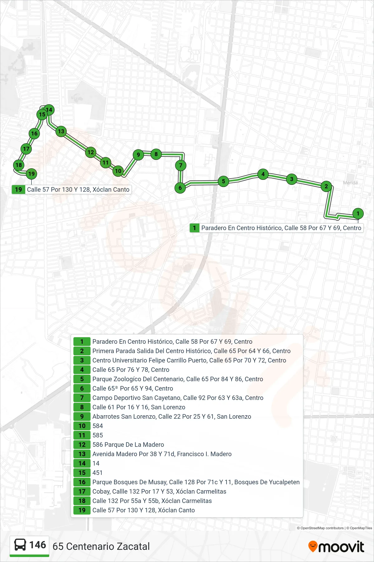
Stops list (146 - 65 Centenario Zacatal)
- Paradero En Centro Histórico, Calle 58 Por 67 Y 69, Centro
- Primera Parada Salida Del Centro Histórico, Calle 65 Por 64 Y 66, Centro
- Centro Universitario Felipe Carrillo Puerto, Calle 65 Por 70 Y 72, Centro
- Calle 65 Por 76 Y 78, Centro
- Parque Zoologíco Del Centenario, Calle 65 Por 84 Y 86, Centro
- Calle 65ᴮ Por 65 Y 94, Centro
- Campo Deportivo San Cayetano, Calle 92 Por 63 Y 63a, Centro
- Calle 61 Por 16 Y 16, San Lorenzo
- Abarrotes San Lorenzo, Calle 22 Por 25 Y 61, San Lorenzo
- 584
- 585
- 586 Parque De La Madero
- Avenida Madero Por 38 Y 71d, Francisco I. Madero
- 14
- 451
- Parque Bosques De Musay, Calle 128 Por 71c Y 11, Bosques De Yucalpeten
- Cobay, Callle 132 Por 17 Y 53, Xóclan Carmelitas
- Calle 132 Por 55a Y 55b, Xóclan Carmelitas
- Calle 57 Por 130 Y 128, Xóclan Canto