
148 Bus Route Map
View the 148 route map and see all 148 stops along the route. The map of 148 shows where the bus travels and the location of each stop, making it easy to understand the entire route at a glance.
Explore Kavim routes on the map and see where Kavim bus services operate. Use the 148 map to find bus stops and see how the 148 connects different areas along its trip.
All 148 stops on the map are displayed in route order, helping you follow the 148 bus from the first stop to the last.
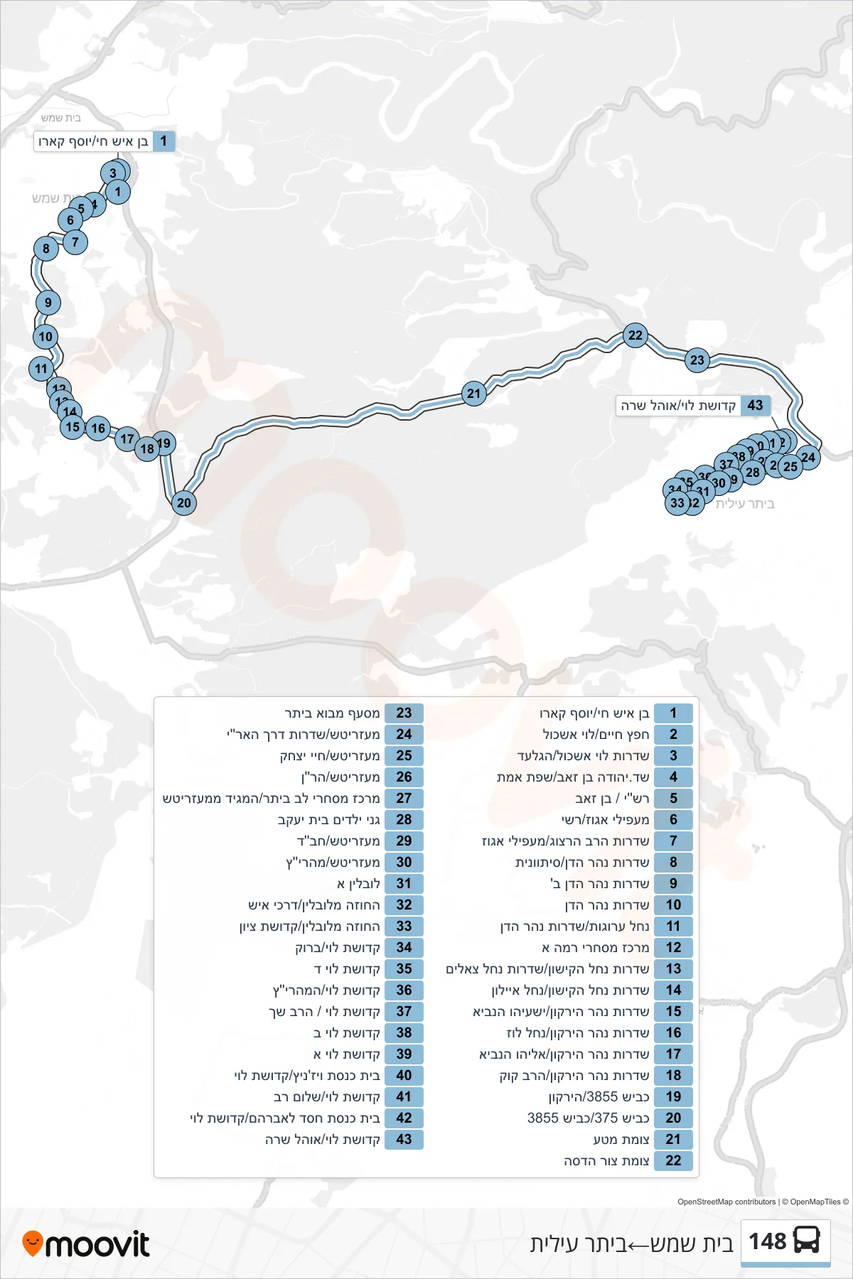
Stops list (148 - Beit Shemesh→Beitar Illit)
- Ben Ish Chai/Yosef Caro
- Hafetz Haim/Levi Eshkol
- Levi Eshkol Boulevard/HaGilad
- Yehuda Ben Zeev Blvd/Sfat Emet
- Rashi/Ben Zeev
- Ma'apilei Egoz/Rashi
- Herzog Boulevard/Ma'apilei Egoz
- Nahar HaYarden Boulevard/Sitvanit
- Nahar HaYarden Boulevard B
- Nahar HaYarden Boulevard
- Nahal Arugot/Jordan River Boulevard
- Rama A Commercial Center
- Nahal Kishon Boulevard/Nahal Tzealim Boulevard
- Nachal HaKishon Boulevard/Nachal Ayalon
- Yarkon River Boulevard/Isaiah the Prophet
- Yarkon River Blvd/Nachal Luz
- Yarkon River Boulevard/Eliyahu HaNavi
- Yarkon River Boulevard/HaRav Kook
- Road 3855/HaYarkon
- Road 375/Road 3855
- Mata Junction
- Tzur Hadassah Junction
- Mevo Beitar Junction
- Mezeritch/HaAri Boulevard
- Mezeritch/Chayei Yitzhak
- Mezeritch/HaRan
- Beitar Commercial Center/Maggid of Mezeritch
- Beit Yaakov Kindergartens
- Mezeritch/Chabad
- Mezritsh/Maharitz
- Lublin A
- Chozeh of Lublin/Darkei Ish
- Chozeh of Lublin/Kedushat Zion
- Kedushat Levi/Brook
- Kedushat Levi D
- Kedushat Levi/HaMaharitz
- Kedushat Levi/HaRav Shach
- Kedushat Levi B
- Kedushat Levi A
- Vizhnitz Synagogue/Kedushat Levi
- Kdushat Levi/Shalom Rav
- Hesed L'Avraham Synagogue/Kedushat Levi
- Kedushat Levi/Ohel Sarah