
15 Bus Route Map
View the 15 route map and see all 15 stops along the route. The map of 15 shows where the bus travels and the location of each stop, making it easy to understand the entire route at a glance.
Explore Lowell Regional Transit Authority routes on the map and see where Lowell Regional Transit Authority bus services operate. Use the 15 map to find bus stops and see how the 15 connects different areas along its trip.
All 15 stops on the map are displayed in route order, helping you follow the 15 bus from the first stop to the last.
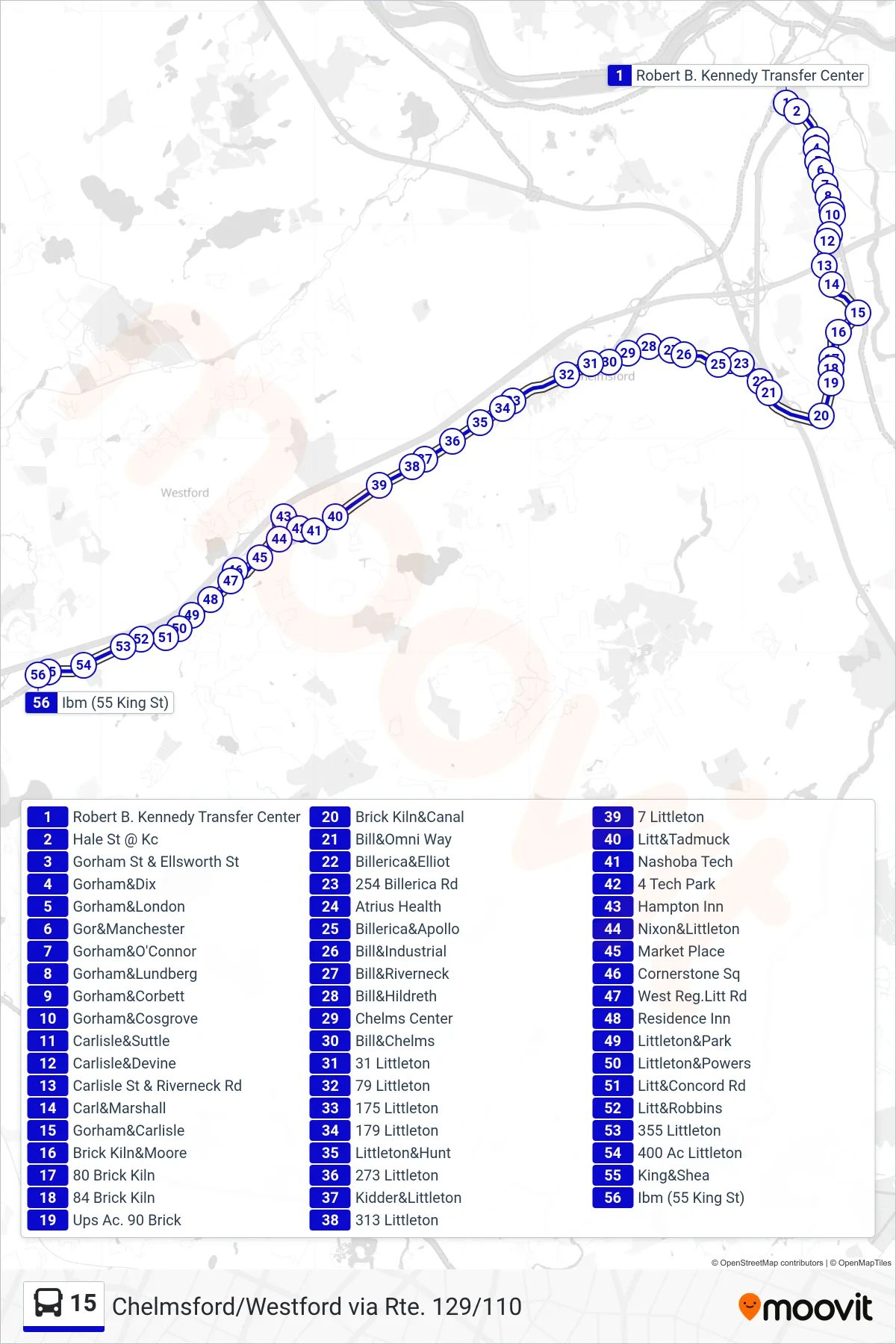
Stops list (15 - Chelmsford/Westford Via Rte. 129/110)
- Robert B. Kennedy Transfer Center
- Hale St @ Kc
- Gorham St & Ellsworth St
- Gorham&Dix
- Gorham&London
- Gor&Manchester
- Gorham&O'Connor
- Gorham&Lundberg
- Gorham&Corbett
- Gorham&Cosgrove
- Carlisle&Suttle
- Carlisle&Devine
- Carlisle St & Riverneck Rd
- Carl&Marshall
- Gorham&Carlisle
- Brick Kiln&Moore
- 80 Brick Kiln
- 84 Brick Kiln
- Ups Ac. 90 Brick
- Brick Kiln&Canal
- Bill&Omni Way
- Billerica&Elliot
- 254 Billerica Rd
- Atrius Health
- Billerica&Apollo
- Bill&Industrial
- Bill&Riverneck
- Bill&Hildreth
- Chelms Center
- Bill&Chelms
- 31 Littleton
- 79 Littleton
- 175 Littleton
- 179 Littleton
- Littleton&Hunt
- 273 Littleton
- Kidder&Littleton
- 313 Littleton
- 7 Littleton
- Litt&Tadmuck
- Nashoba Tech
- 4 Tech Park
- Hampton Inn
- Nixon&Littleton
- Market Place
- Cornerstone Sq
- West Reg.Litt Rd
- Residence Inn
- Littleton&Park
- Littleton&Powers
- Litt&Concord Rd
- Litt&Robbins
- 355 Littleton
- 400 Ac Littleton
- King&Shea
- Ibm (55 King St)