
15 Bus Route Map
View the 15 route map and see all 15 stops along the route. The map of 15 shows where the bus travels and the location of each stop, making it easy to understand the entire route at a glance.
Explore MBTA routes on the map and see where MBTA bus services operate. Use the 15 map to find bus stops and see how the 15 connects different areas along its trip.
All 15 stops on the map are displayed in route order, helping you follow the 15 bus from the first stop to the last.
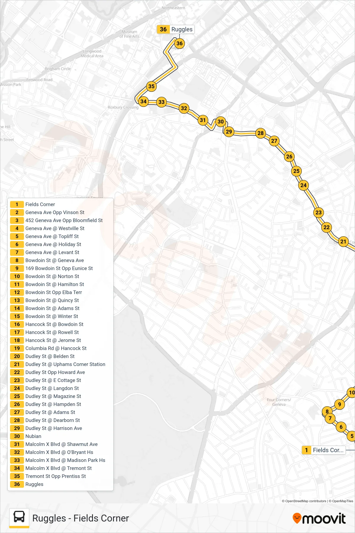
Stops list (15 - Ruggles)
- Fields Corner
- Geneva Ave Opp Vinson St
- 452 Geneva Ave Opp Bloomfield St
- Geneva Ave @ Westville St
- Geneva Ave @ Topliff St
- Geneva Ave @ Holiday St
- Geneva Ave @ Levant St
- Bowdoin St @ Geneva Ave
- 169 Bowdoin St Opp Eunice St
- Bowdoin St @ Norton St
- Bowdoin St @ Hamilton St
- Bowdoin St Opp Elba Terr
- Bowdoin St @ Quincy St
- Bowdoin St @ Adams St
- Bowdoin St @ Winter St
- Hancock St @ Bowdoin St
- Hancock St @ Rowell St
- Hancock St @ Jerome St
- Columbia Rd @ Hancock St
- Dudley St @ Belden St
- Dudley St @ Uphams Corner Station
- Dudley St Opp Howard Ave
- Dudley St @ E Cottage St
- Dudley St @ Langdon St
- Dudley St @ Magazine St
- Dudley St @ Hampden St
- Dudley St @ Adams St
- Dudley St @ Dearborn St
- Dudley St @ Harrison Ave
- Nubian
- Malcolm X Blvd @ Shawmut Ave
- Malcolm X Blvd @ O'Bryant Hs
- Malcolm X Blvd @ Madison Park Hs
- Malcolm X Blvd @ Tremont St
- Tremont St Opp Prentiss St
- Ruggles