
15 Bus Route Map
View the 15 route map and see all 15 stops along the route. The map of 15 shows where the bus travels and the location of each stop, making it easy to understand the entire route at a glance.
Explore Metropoline routes on the map and see where Metropoline bus services operate. Use the 15 map to find bus stops and see how the 15 connects different areas along its trip.
All 15 stops on the map are displayed in route order, helping you follow the 15 bus from the first stop to the last.
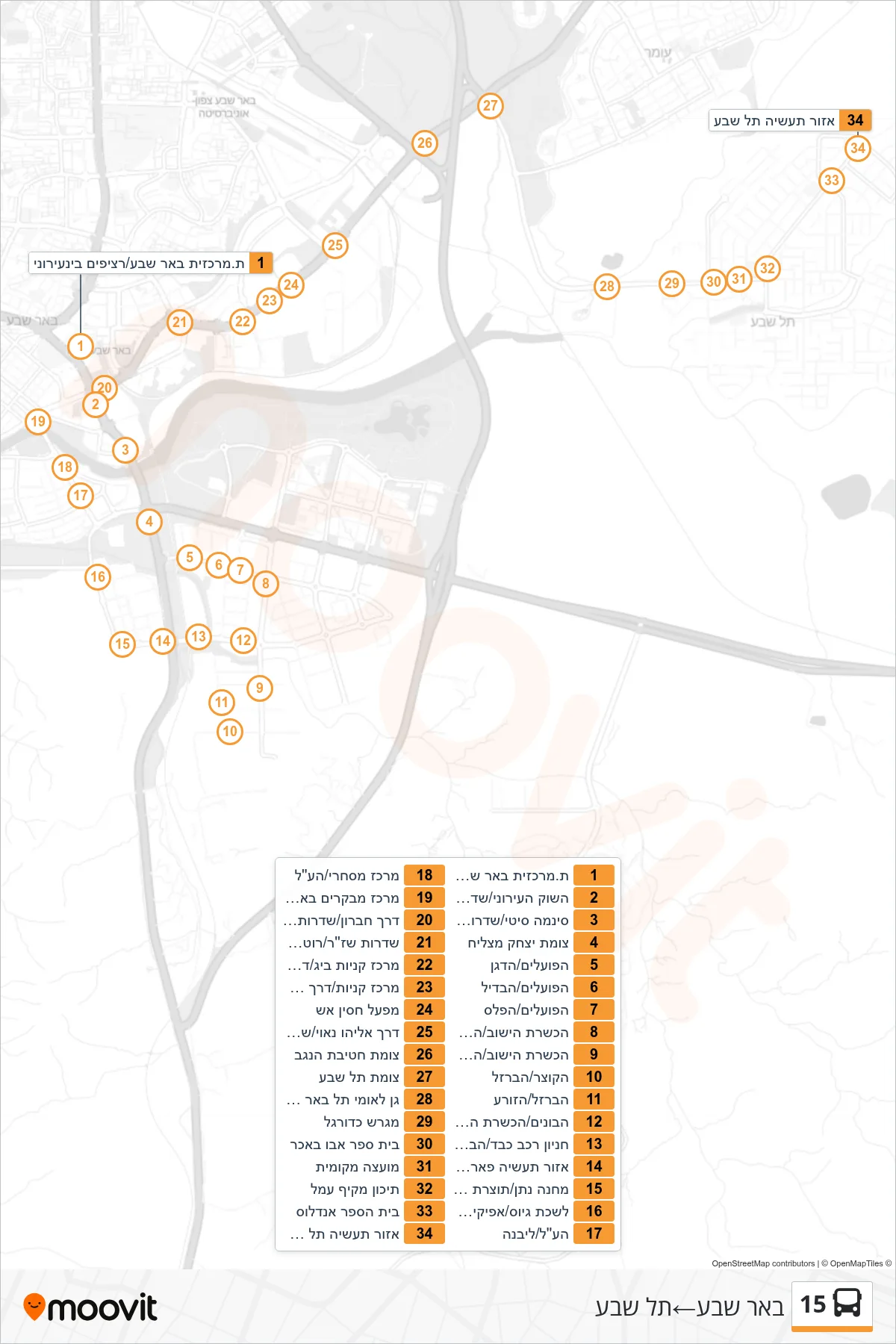
Stops list (15 - Beer Sheva→Tel Sheva)
- Beer Sheva Central Station/Intercity Platforms
- City Market/David Hacham Boulevard
- Cinema City/David Hacham Boulevard
- Yitzhak Matzliach Junction
- HaPoalim/HaDagan
- HaPoalim/HaBdil
- HaPoalim/HaPeles
- Hachsharat HaYishuv/HaPoalim
- Hachsharat HaYishuv/HaChoresh
- HaKotzer/HaBarzel
- HaBarzel/HaZorea
- HaBonim/Hachsharat HaYishuv
- Heavy Vehicle Parking/HaBonim
- Ofir Industrial Park/Totzeret HaAretz
- Machane Natan/Totzeret HaAretz
- Recruitment Office/Afikim BaNegev
- Ha'Al/Livne
- Commercial Center/Ha'al
- Beer Avraham Visitors Center/Ha'al
- Hebron Road/David Hacham Boulevard
- Shazar Boulevard/Rothschild
- Big Shopping Center/Eliyahu Nave Road
- Shopping Center/Eliyahu Navoi Road
- Hasin Esh Factory
- Eliyahu Nave Road/Ben Gurion Boulevard
- Hativat HaNegev Junction
- Tel Sheva Junction
- Tel Be'er Sheva National Park
- Soccer Field
- Abu Bakr School
- Local Council
- Amal Comprehensive High School
- Al-Andalus School
- Tel Sheva Industrial Zone