
15 Bus Route Map
View the 15 route map and see all 15 stops along the route. The map of 15 shows where the bus travels and the location of each stop, making it easy to understand the entire route at a glance.
Explore Stadtwerke Marburg GmbH routes on the map and see where Stadtwerke Marburg GmbH bus services operate. Use the 15 map to find bus stops and see how the 15 connects different areas along its trip.
All 15 stops on the map are displayed in route order, helping you follow the 15 bus from the first stop to the last.
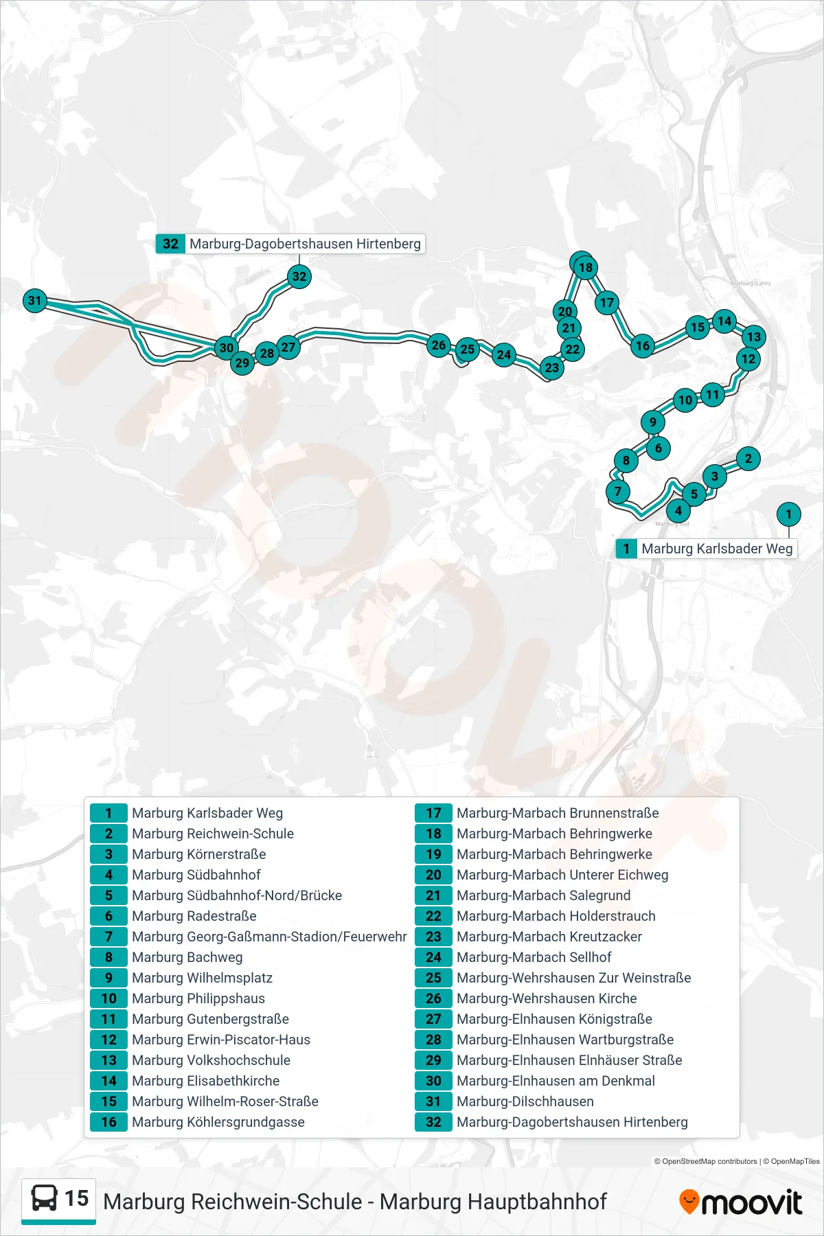
Stops list (15 - Marburg-Dagobertshausen Hirtenberg)
- Marburg Karlsbader Weg
- Marburg Reichwein-Schule
- Marburg Körnerstraße
- Marburg Südbahnhof
- Marburg Südbahnhof-Nord/Brücke
- Marburg Radestraße
- Marburg Georg-Gaßmann-Stadion/Feuerwehr
- Marburg Bachweg
- Marburg Wilhelmsplatz
- Marburg Philippshaus
- Marburg Gutenbergstraße
- Marburg Erwin-Piscator-Haus
- Marburg Volkshochschule
- Marburg Elisabethkirche
- Marburg Wilhelm-Roser-Straße
- Marburg Köhlersgrundgasse
- Marburg-Marbach Brunnenstraße
- Marburg-Marbach Behringwerke
- Marburg-Marbach Behringwerke
- Marburg-Marbach Unterer Eichweg
- Marburg-Marbach Salegrund
- Marburg-Marbach Holderstrauch
- Marburg-Marbach Kreutzacker
- Marburg-Marbach Sellhof
- Marburg-Wehrshausen Zur Weinstraße
- Marburg-Wehrshausen Kirche
- Marburg-Elnhausen Königstraße
- Marburg-Elnhausen Wartburgstraße
- Marburg-Elnhausen Elnhäuser Straße
- Marburg-Elnhausen am Denkmal
- Marburg-Dilschhausen
- Marburg-Dagobertshausen Hirtenberg
Change direction
- Route Map - 15 - Marburg-Marbach Behringwerke
- Route Map - 15 - Marburg-Michelbach Lindenplatz
- Route Map - 15 - Marburg Hauptbahnhof
- Route Map - 15 - Marburg Karlsbader Weg
- Route Map - 15 - Marburg Reichwein-Schule
- Route Map - 15 - Marburg Wilhelmsplatz
- Route Map - 15 - Marburg-Wehrshausen Zur Weinstraße
- Route Map - 15 - Marburg Südbahnhof-Nord/Brücke