
15 Bus Route Map
View the 15 route map and see all 15 stops along the route. The map of 15 shows where the bus travels and the location of each stop, making it easy to understand the entire route at a glance.
Explore WestCat (Western Contra Costa) routes on the map and see where WestCat (Western Contra Costa) bus services operate. Use the 15 map to find bus stops and see how the 15 connects different areas along its trip.
All 15 stops on the map are displayed in route order, helping you follow the 15 bus from the first stop to the last.
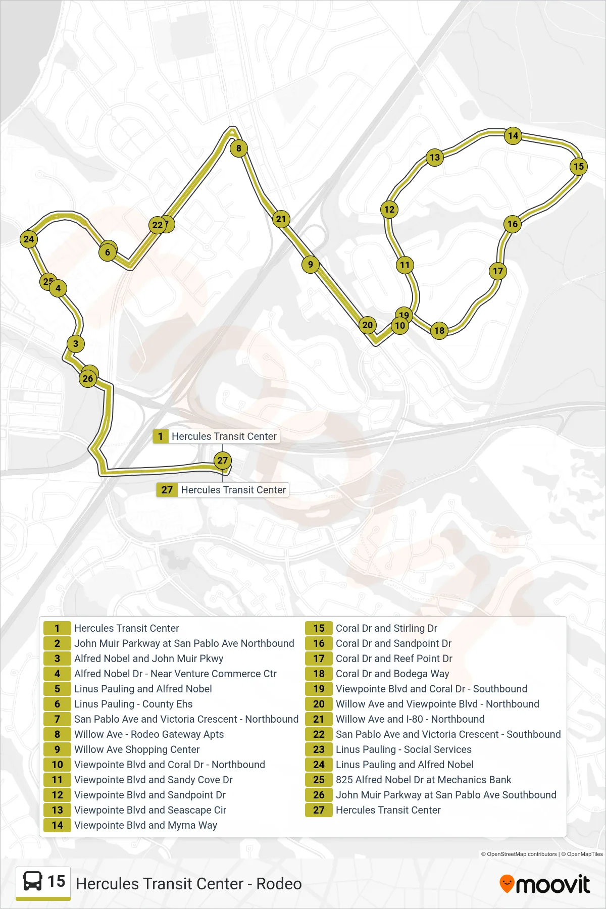
Stops list (15 - Loop Route)
- Hercules Transit Center
- John Muir Parkway at San Pablo Ave Northbound
- Alfred Nobel and John Muir Pkwy
- Alfred Nobel Dr - Near Venture Commerce Ctr
- Linus Pauling and Alfred Nobel
- Linus Pauling - County Ehs
- San Pablo Ave and Victoria Crescent - Northbound
- Willow Ave - Rodeo Gateway Apts
- Willow Ave Shopping Center
- Viewpointe Blvd and Coral Dr - Northbound
- Viewpointe Blvd and Sandy Cove Dr
- Viewpointe Blvd and Sandpoint Dr
- Viewpointe Blvd and Seascape Cir
- Viewpointe Blvd and Myrna Way
- Coral Dr and Stirling Dr
- Coral Dr and Sandpoint Dr
- Coral Dr and Reef Point Dr
- Coral Dr and Bodega Way
- Viewpointe Blvd and Coral Dr - Southbound
- Willow Ave and Viewpointe Blvd - Northbound
- Willow Ave and I-80 - Northbound
- San Pablo Ave and Victoria Crescent - Southbound
- Linus Pauling - Social Services
- Linus Pauling and Alfred Nobel
- 825 Alfred Nobel Dr at Mechanics Bank
- John Muir Parkway at San Pablo Ave Southbound
- Hercules Transit Center